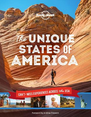
From the tiny gold-rush town of Chicken, Alaska to Las Vegas' dazzling Neon Museum and Maryland's famous blue crab, Lonely Planet's Unique States of America takes you on a journey across the 50 states to discover the country's most iconic - and unique - destinations and experiences. Travel off the beaten path and into the heart of each state with our expert itineraries exploring some of the USA's finest art and culture, food and drink, history, sports, and family-friendly places. Get fascinating...
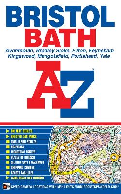
This paperback edition of the A-Z Bristol and Bath Street Atlas includes coverage of:*Avonmouth*Bradley Stoke*Filton*Keynsham*Kingswood*Mangotsfield*Portishead*Yate The 104 pages of continuous street mapping extends to include:*Frampton Cotterell*Chipping Sodbury*Oldland*Swainswick*Batheaston*University of Bath*Combe Down*Bath Spa University*Saltford*Whitchurch*Bedminster*Long Ashton*Easton-in-Gordano*Cribbs Causeway*Filton Also included are large scale city centre maps of bo...
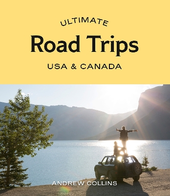
Ultimate Road Trips USA & Canada provides detailed itineraries for 32 amazing driving routes and adventures, from enthralling national parks to charming small towns. Including epic journeys like California’s Highway 1, the Canadian Rockies, coastal New England, Hawaii and Alaska, each chapter features route maps and colour photos. This guide also has descriptions of all the must-see highlights including short hikes, family-friendly attractions and world-class museums, and the best places to eat...
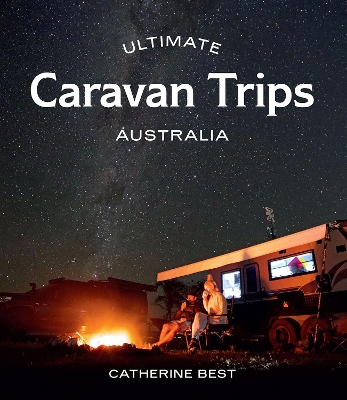
Ultimate Caravan Trips: Australia is your ticket to #vanlife. This caravanner's travel bible lifts the lid on 40 of the best adventures you can have on six (or eight) wheels. Organised into state and territory chapters, it is packed with wanderlust to inspire your next caravan trip, from weekend escapes to week-long breaks and multi-destination touring itineraries. Fancy unhitching by the Noosa Everglades, parking up on the sand on the Eyre Peninsula, or winding out the awning riverside in t...
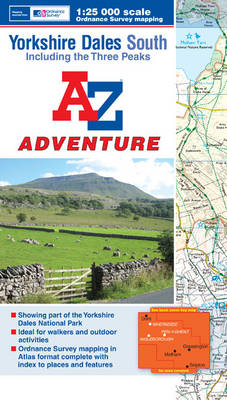
The A-Z Adventure series features the accuracy and quality of OS 1:25000 mapping in a convenient book, complete with index. The A-Z Adventure series is an innovative concept that utilises Ordnance Survey 1:25000 mapping in a book, therefore eliminating the need to fold and refold a large sheet map to the desired area. OS 1:25000 is Ordnance Survey's most detailed mapping, showing public rights of way, open access land, national parks, tourist information, car parks, public houses and c...
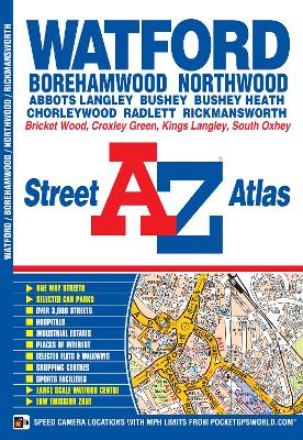
This A-Z map of Watford, Borehamwood, Bushey, Rickmansworth and Radlett features 31 street map pages extending to:*Chorleywood*Chandler's Cross*Hunton Bridge*Kings Langley (part)*Abbots Langley*Bricket Wood*Colney Street*M1 London Gateway Service Area*Elstree*South Oxhey*Northwood (part) Also included is a large scale town centre map of Watford. Postcode districts, one-way streets, safety camera locations with speed limits and the Greater London Low Emission Zone boundary are...
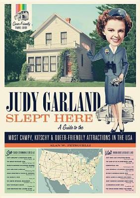
Alan W. Petrucelli's Judy Garland Slept Here is a campy, kitschy, one-of-a-kind travel guide to some of the most iconic queer-friendly sights, destinations, and attractions in the USA. Entertaining, gossipy, and always fun, Judy Garland Slept Here is the essential travel guide for LGBTQ and anyone who loves general fabulousness. Petrucelli has spent five decades meandering down byways and back roads and brick roads (yellow and other colors), amassing information that's accurate and up-to-date, a...
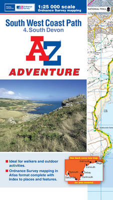
The A-Z Adventure series features the accuracy and quality of OS 1:25000 mapping in a convenient book, complete with index. The A-Z Adventure series is an innovative concept that utilizes Ordnance Survey 1:25000 mapping in a book, therefore eliminating the need to fold and re-fold a large sheet map to the desired area. OS 1:25000 is Ordnance Survey's most detailed mapping, showing public rights of way, open access land, national parks, tourist Information, car parks, public houses and...
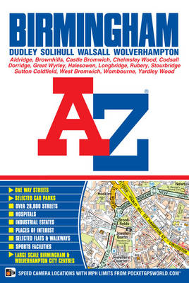
This spiral bound map of Birmingham includes coverage of:*Birmingham*Bloxwich*Dudley*Sedgley*Solihull*Stourbridge*Walsall*West Bromwich*Wolverhampton The atlas includes 164 street map pages extending to include:*Aldridge*Brownhills*Castle Bromwich*Dorridge*Great Wyrley*Halesowen*Knowle*Longbridge*Oldbury*Smethwick*Sutton Coldfield*Wednesfield*Wombourne Also included are large scale city centre maps of Birmingham and Wolverhampton and a West Midlands rail and Midland Metro tra...
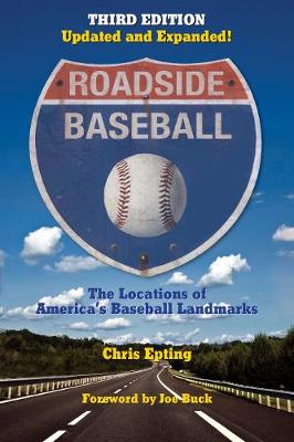
Roadside Baseball: The Locations of America's Baseball Landmarks
by Chris Epting
Capturing such quintessentially American pastimes as baseball and road trips in one fascinating work, the updated and expanded third edition of Chris Epting's Roadside Baseball chronicles more than 500 important events in baseball history, with detailed descriptions of the event and information on each location. Packed with historical data, trivia, photographs, and baseball lore, entries include the birthplaces of baseball legends, ballparks, museums and halls of fame, final resting places, and...

Highway 25 in the Carolinas (Transportation)
by Anne Peden and James Scott
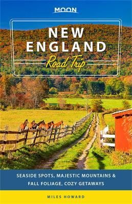
Moon New England Road Trip (Second Edition) (Travel Guide)
by Miles Howard
From the misty mountains in Maine to the coastal charms of Cape Cod, there's no shortage of adventure in New England: Get ready to hit the road with Moon New England Road Trip. Inside you'll find:* Multiple Routes: Choose from flexible road trips like a fall foliage tour, getaways from the cities, or the ultimate two-week route through all of New England* Eat, Sleep, Stop and Explore: With lists of the best hikes, views, eateries, and more, you can trek among spruce trees in the White Mountains,...
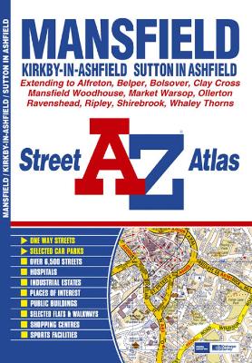
This atlas of Mansfield, Kirkby-in-Ashfield and Sutton-in-Ashfield features 64 pages of coloured street mapping with coverage extending to: Bolsover, Whaley, Whaley Thorns, Norton, Budby, New Ollerton, Edwinstowe, Clipstone, Rainworth, Blidworth, Ravenshead, Newstead, Selston, Brinsley, Ripley, Belper, Swanwick, Alfreton, Higham, Clay Cross and Grassmoor. Postcode districts and one-way streets are featured on the mapping. The index section of the atlas lists streets...

This atlas contains 37 pages of coloured street mapping that cosists of separate coverages of:*Bangor, Beaumaris (Biwmares), Menai Bridge (Porthaethwy) and Llanfair Pwllgwyngyll. Llanfairfechan, Penmaenmawr and Dwygyfylchi.Conwy, Llandudno, Penrhyn Bay (Bae Penrhyn), Colwyn Bay (Bae Colwyn), Abergele, Kinmel Bay (Bae Cinmel), Rhyl (Y Rhyl), Prestatyn, Rhuddlan, Dyserth, Bodelwyddan and St. Asaph (Llan-Elwy).Denbigh (Dinbych).Caernarfon including a large scale town centre plan....
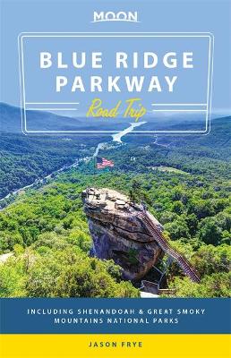
Moon Blue Ridge Parkway Road Trip (Travel Guide) (Moon Handbooks)
by Jason Frye
The Blue Ridge Parkway connects the green valleys of Shenandoah National Park to the Great Smoky Mountains. Drive America's most scenic motorway with Moon Blue Ridge Parkway Road Trip. Inside you'll find: *Maps and Driving Tools: 29 easy-to-use maps keep you oriented on and off the motorway, along with site-to-site mileage, driving times, and detailed directions for the entire route*Eat, Sleep, Stop and Explore: Listen to live bluegrass music with a glass of local moonshine, drive past fields b...
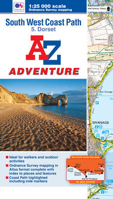
The A-Z Adventure series features the accuracy and quality of OS 1:25000 mapping in a convenient book, complete with index. An innovative concept, the A-Z Adventure series utilises Ordnance Survey 1:25000 mapping in a book, therefore eliminating the need to fold and re-fold a large sheet map to the desired area. OS 1:25000 is Ordnance Survey's most detailed mapping, showing public rights of way, open access land, national parks, tourist information, car parks, public houses and camping...
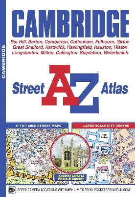
This new A-Z map of Cambridge is a full colour street atlas and for the first time, features a places of interest guide. Now with extended coverage, this publication has 48 pages of continuous street mapping to include:*Longstanton*Cottenham*Waterbeach*Milton*Fulbourn*Great Shelford*Highfields Caldecote*Bar Hill In addition, there is a large scale map of Cambridge city centre. Postcode districts, one-way streets and safety camera locations with their maximum speed are also fe...
This A-Z map of York is a full colour street atlas and for the first time, features a places of interest guide. This publication has 50 pages of continuous street mapping which extends to cover:*Strensall*Skelton*Haxby*Stamford Bridge (inset)*Dunnington*Wheldrake*Escrick*Copmanthorpe*Rufforth In addition, there is seperate coverage of Tadcaster, Riccall, Barlby and Selby and a large scale map of York city centre. Postcode districts, one-way streets and Park and Ride sites are...
Catch a wave, hike to the Hollywood sign, or soak up some desert sun: the possibilities are endless with Moon Southern California Road Trips. Inside you'll find:*Pick Your Road Trip: Find flexible getaways throughout SoCal like three-day routes up the coast, through Death Valley, Ojai, and more, or combine them for an epic two-week driving tour*Eat, Sleep, Stop and Explore: With lists of the best beaches, hikes, wineries, and more, you can tour backlots in Los Angeles, feel like a kid again at D...