"Travel Map Northern Spain" is an indexed, road map at 1:800 000. It includes detailed city plans of Barcelona, Bilbao & Madrid, each with its own separate index. Places of interest, including national parks, nature reserves and heritage sites, are listed and depicted by a wide range of pictorial symbols for instant recognition. These symbols have been colour coded by category. In addition to the road and rail networks, ferry routes and airports, this map provides an overview of the topography through the use of relief shading, with mountain ranges named and peak heights given. An inset chart gives additional information regarding access restrictions, altitude and tolls on mountain passes and tunnels in the Pyrenees. Handy distance indicators, located in the margin, give distances to the nearest town, major locations and motorway junction, if applicable. Intermediate driving distances are shown on main and secondary roads. The extensive legend is shown in 8 languages.
"Travel Map Southern Spain" is a double-sided, indexed, road map at 1: 8, 00 000. Detailed city plans of Seville, Valencia and Lisbon are included, each with its own index listing. Additional maps cover the Balearic and Canary Islands, the Azores and Madeira. Places of interest including museums, monuments and religious sites are listed and accompanied by a wide range of pictorial symbols for instant recognition, these symbols have been colour coded by category. In addition to the road and rail networks, airports, major ports and ferry routes, this map provides a detailed picture of the topography through the use of relief shading. National parks, valleys, mountain ranges with peak heights, nature reserves, trekking areas and sailing areas are clearly indicated. This map has handy distance indicators in the margin and shows intermediate driving distances on main roads. The extensive legend is shown in 8 languages.
"Travel Map Northern Italy & French Riviera" is an indexed, road map at 1:800 000. It includes detailed city plans of Bologna, Florence, Milan, Venice & Nice, each with its own separate index. Places of interest, including national parks, nature reserves and heritage sites, are listed and depicted by a wide range of pictorial symbols for instant recognition. These symbols have been colour coded by category. In addition to the road and rail networks, ferry routes and airports, this map provides an overview of the topography through the use of relief shading, with mountain ranges named and peak heights given. Mountain passes show gradients for steep ascents. Handy distance indicators, located in the margin, give distances to the nearest town, major locations and motorway junction, if applicable. Intermediate driving distances are given on main and secondary roads. The extensive legend is shown in 4 languages.
"Travel Map New Zealand" shows the North Island on one side of the map and South Island on the other, using a scale of 1: 8, 00 000. It includes detailed street plans of Auckland, Wellington and Christchurch, each with their own separate index. The Places of Interest index is accompanied by a wide range of pictorial symbols for instant recognition; these symbols have been colour coded by category, and website addresses are also given for most entries. In addition to the countries' road and rail networks and ferry routes, this map provides a detailed picture of the topography through the use of relief shading. National parks, mountain ranges and restricted areas are shown. This map has handy distance indicators in the margin and shows intermediate driving distances on main roads. The extensive legend is shown in 8 languages.
"Travel Map Switzerland" is a double-sided, indexed, road map at 1:200 000. It includes detailed city plans of Basel, Bern, Geneva, Lausanne, Lucerne, St Gallen and Zurich. In addition to the road and rail networks, ferry routes and airports, this map provides an overview of the topography through the use of relief shading, with mountain ranges named and peak heights given. Mountain passes show gradients for steep ascents and roads closed to motor vehicles are clearly marked. Places of interest, including castles and ruins, churches, museums and heritage sites are highlighted. Handy distance indicators, located in the margin, give distances to the nearest town, major locations and motorway junction, if applicable. Intermediate driving distances are marked on main roads. The extensive legend is shown in 8 languages.
South Africa at 1:1,500,000 on a very large, indexed map from Insight Guides with street plans of Cape Town, Johannesburg, Durban and Pretoria, plus enlargements showing in greater detail the Cape Peninsula, the Kruger National Park, plus the iSimagaliso Wetland Park with the Hluhluwe National Park.On one side is the main map covering South Africa at 1:1,500,000 with southern Namibia, much of southern Botswana, Swaziland and the southern coast of Mozambique around Maputo. Relief shading shows the topography with names of mountain ranges and main peaks. National parks and protected areas are highlighted. The map shows a large number of smaller towns and villages. Both principal highways and connecting secondary roads are clearly numbered, with driving distances shown on main routes. Railway lines are included and airports are marked. Road maps from the Insight Guides indicate towns worth visiting and include a wide range of small icons prominently highlighting various places of interest. The map has no geographical coordinates.Enlargements and street plans, all annotated with places of interest, show the Cape Peninsula, the Kruger National Park, and the iSimagaliso Wetland Park with the Hluhluwe National Park, plus Cape Town, Johannesburg, Durban and Pretoria. The indexes for the main map and for the enlargements and street plans all include separate lists of places of interest highlighted on them. Also provided is a general map of the southern part of Africa.
"Travel Map Northern France" is an indexed, road map at 1:800 000. It includes a city plan of Paris and an enlarged road map of the Paris area. Places of interest, including national parks, nature reserves and heritage sites, are listed and accompanied by a wide range of pictorial symbols for instant recognition. These symbols have been colour coded by category. In addition to the road and rail networks, ferry routes and airports, this map provides an overview of the topography through the use of relief shading, with mountain ranges named and peak heights given. Mountain passes show gradients for steep ascents. Handy distance indicators, located in the margin, give distances to the nearest town, major locations and motorway junction, if applicable. Intermediate driving distances are shown on main and secondary roads. The extensive legend is shown in 8 languages.
"Travel Map Portugal" is a double-sided, indexed, road map at 1:800 000. It includes detailed city plans of Lisbon, Oporto, Faro and Portimao together with a plan of Seville in Spain, each city its own separate index listing. Also included is a detailed enlargement of the Algarve, shown at 1:200 000. Places of interest, including national parks, nature reserves and heritage sites, are listed and depicted by a wide range of pictorial symbols for instant recognition. These symbols have been colour coded by category. Website addresses are also given for most sights. In addition to the road and rail networks, this map provides an overview of the topography through the use of relief shading, with spot heights shown for the main peaks. Handy distance indicators, located in the margin, give distances to the nearest town, major locations and motorway junction, if applicable. Intermediate driving distances are marked on main roads. The extensive legend is shown in 8 languages.
"Travel Map France" is a double-sided, indexed, road map at 1:800 000. Detailed city plans of Paris, Bordeaux, Lyon, Marseille, Nice and Cannes are included, each with its own separate listing in the attached index booklet. Places of interest are listed and accompanied by a wide range of pictorial symbols for instant recognition. These symbols have been colour coded by category. In addition to the road and rail networks, ferry routes and airports, this map provides an overview of the topography through the use of relief shading, with mountain ranges named and peak heights given. Handy distance indicators, located in the margin, give distances to the nearest town, major locations and motorway junction, if applicable, intermediate driving distances are given on main roads. The extensive legend is shown in 8 languages.
"Travel Map Andalucia, Costa del Sol" is a double-sided, indexed, road map at 1:300 000. Detailed city plans of Seville, Granada, Cordoba, Malaga, Marbella, Cadiz and Ronda are included, each with its own index listing. Places of interest including museums, monuments and religious sites are listed and accompanied by a wide range of pictorial symbols for instant recognition, these symbols have been colour coded by category. Website addresses are also given for most entries. In addition to the road and rail networks, airports and ferry ports, this map provides a detailed picture of the topography through the use of relief shading. National parks, valleys, mountain ranges with peak heights, nature reserves, trekking areas and sailing areas are clearly indicated. This map has handy distance indicators in the margin giving distances to nearest town, major locations and nearest motorway junction, if applicable. Intermediate driving distances are shown on main roads. The extensive legend is shown in 8 languages.
"Travel Map New England" is a double-sided, indexed, road map at 1:800 000. It includes detailed city plans of New York, Boston, Hartford, Philadelphia and Providence as well as Montreal, Quebec and Toronto in Canada. Each city plan has its own separate listing in the attached index booklet. Places of interest, including national parks, nature reserves and heritage sites, are listed and depicted by a wide range of pictorial symbols for instant recognition. These symbols have been colour coded by category. Website addresses are also given for most entries in the index booklet. In addition to the road and rail networks, ferry routes and airports, this map provides an overview of the topography through the use of relief shading, with spot heights shown for the main peaks. This map also includes an enlargement of Cape Cod, Martha's Vineyard and Nantucket Island at a scale of 1:150 000. It shows ferry routes between the islands, the months when each service is available and the expected duration of the trip. Handy distance indicators, located in the margin, give distances to the nearest town, major locations and motorway junction, if applicable. Intermediate driving distances are given on main roads. The extensive legend is shown in 8 languages.
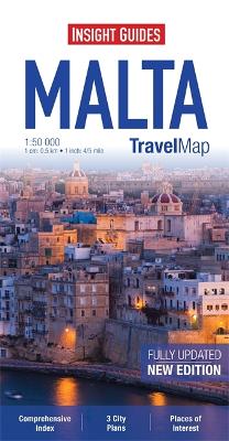
"Travel Map Malta" is an indexed, road map at 1:50 000 which also covers Gozo and Comino. It includes detailed city plans of Mdina, Valletta & Victoria, each with its own separate index. Places of interest, including nature parks, museums and monuments are listed and depicted by a wide range of pictorial symbols for instant recognition. These symbols have been colour coded by category. The island's topography is illustrated by the use of relief shading with many spot heights shown. In addition to the road network, ferry routes are marked and an inset map shows an overview of the ferry links between Malta and southern Sicily. The extensive legend is shown in 8 languages.