
The atlas's big picture and road details help you on your journey, for advance planning and consulting en route, while its tiled map pages complement online driving directions and GPS systems. Take to the road with confidence with Michelin's North America atlas. Covers USA, Canada and Mexico. Scale 1:625,000 & 1:9,018,000. In addition of Michelin clear and accurate mapping, USA-Canada-Mexico road atlas features: * Covers USA, Canada and Mexico. Scale 1:625,000 - 1:9,018,000. * Spiral bound f...
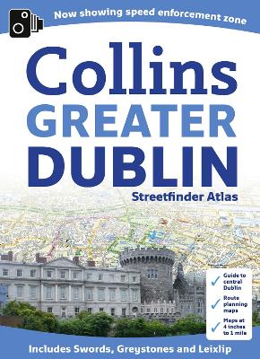
New larger format street atlas of Dublin. Clear, detailed street mapping of Greater Dublin, all fully indexed. Route planning map of whole of Dublin area at 8 miles to 1 inch. Main approaches map at 4 miles to 1 inch. The whole of Dublin mapped at 4.4 inches to 1 mile also includes detailed Central Dublin map. A handy format street atlas of Greater Dublin with clear, detailed street mapping. INCLUDES* Clear colour coded street mapping.* Speed enforement zones.* Fixed safety c...


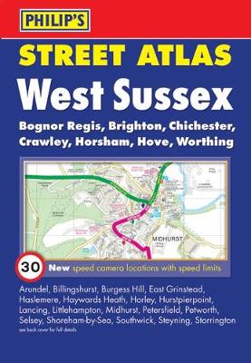
This fully revised pocket-sized street atlas of West Sussex gives comprehensive and detailed coverage of the county. The route planner shows all the A and B roads, and can be used when driving to get close to the destination before turning to the relevant large-scale street map. The street maps show every named road, street and lane very clearly, with major roads picked out in colour. The maps are at a standard scale of 2 2/3 inches to 1 mile, and show postcode boundaries. Other information on t...
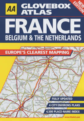
The third edition covers France, Belgium, Luxembourg and the Netherlands/Holland and includes plans of the major cities. In a handy A5 format, with a scale of 16 miles to the inch, it also contains a comprehensive index containing 4500 place names. The atlas includes a route-planning map, a distance chart with the distance shown in kilometres and incorporates toll points and their closure periods, viewpoints and mountain passes.

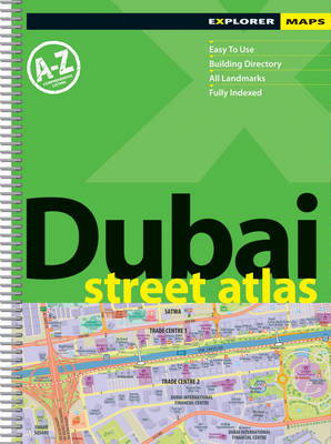
This large scale street atlas features a comprehensive A to Z of Dubai's ever-growing road network, with a thorough index giving the exact location of every street, every hotel, every shopping centre, every landmark, and every major residential and commercial building.Each map spread features a satellite image of the featured area on one page, opposite a detailed vector map of the same area.
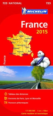
Updated annually, MICHELIN National Map France (booklet format - map 723) will give you an overall picture of your journey thanks to its clear and accurate mapping scale 1/1,000,000. Our map will help you easily plan your safe and enjoyable journey in France thanks to a comprehensive key, a complete name index as well a clever time & distance chart. Michelin's driving information will help you navigate safely in all circumstances. In addition, MICHELIN National Map France is cross-referenced wi...
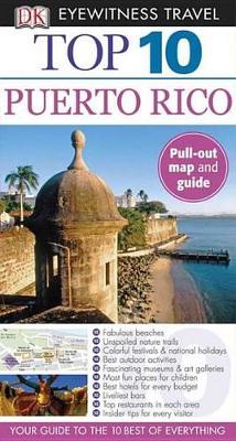
Top 10 Puerto Rico (DK Eyewitness Top 10 Travel Guides)
by Christopher Baker
Cape Town (Street Plan S.)
Durban (Miniplan S.)