ESRI Map Book is an annual volume published to exhibit the most innovative and well-crafted maps displayed at the ESRI International User Conference. This volume continues the tradition of acknowledging the outstanding efforts of GIS users in their respective fields. With more than 20 categories represented by more than 100 full-color maps, ""ESRI Map Book, Volume 24"", tells the story of how GIS professionals are boldly shaping the world that they map.
From medieval maps to digital cartograms, this book features highlights from the Bodleian Library's extraordinary map collection together with rare artefacts and some stunning examples from twenty-first-century map-makers. Each map is accompanied by a narrative revealing the story behind how it came to be made and the significance of what it shows. The chronological arrangement highlights how cartography has evolved over the centuries and how it reflects political and social change. Showcasin...
GIS
Map Worlds plots a journey of discovery through the world of women map-makers from the golden age of cartography in the sixteenth-century Low Countries to tactile maps in contemporary Brazil. Author Will C. van den Hoonaard examines the history of women in the profession, sets out the situation of women in technical fields and cartography-related organizations, and outlines the challenges they face in their careers. Map Worlds explores women as colourists in early times, describes the major hous...
Well before the innovation of maps, gazetteers served as the main geographic referencing system for hundreds of years. Consisting of a specialized index of place names, gazetteers traditionally linked descriptive elements with topographic features and coordinates. Placing Names is inspired by that tradition of discursive place-making and by contemporary approaches to digital data management that have revived the gazetteer and guided its development in recent decades. Adopted by researchers in th...
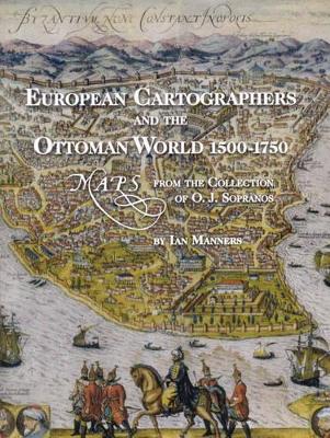
European Cartographers and the Ottoman World, 1500-1750 (Oriental Institute Museum Publications, #27)
by Ian Manners
This lavishly illustrated catalogue of the exhibit European Cartographers and the Ottoman World, 1500-1750, explores how mapmakers sought to document a new geography of the Near East that reconciled classical ideas and theories with the information collected and brought back by travellers and voyagers. The text is accompanied by images of illuminated manuscript charts and atlases, the earliest printed maps of the Ottoman Empire, and bird's-eye views of cities that provided "arm-chair travellers"...
Moving Women Moving Objects (400-1500) (Maps, Spaces, Cultures, #2) (ISSN)
This collection forges new ground in the discussion of aristocratic and royal women, their relationships with their objects, and medieval geography. It explores how women's geographic and familial networks spread well beyond the borders that defined men's sense of region and how the movement of their belongings can reveal essential information about how women navigated these often-disparate spaces. Beginning in early medieval Scandinavia, ranging from Byzantium to Rus', and multiple lands in Wes...
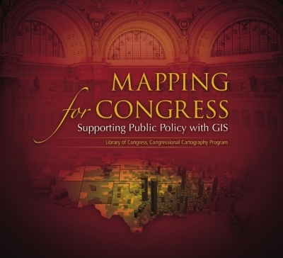
Mapping for Congress: Supporting Public Policy with GIS details how Library of Congress GIS professionals are able to help members of Congress and congressional staff understand public policy issues in a geographic context. Included in the book are more than thirty maps highlighting national trends and providing insight into how these patterns might influence current and future public policy.
After returning from his American research expedition, Alexander von Humboldt worked on an atlas of the "New Continent," the Atlas géographique et physique des régions équinoxiales du Nouveau Continent. The thirty-nine maps in the atlas provide information about the genesis of the Earth and the interaction of the forces of nature as well as the cultural-historical development of geographic knowledge itself. Amrei Buchholz describes the conception and production of the atlas for the first time. S...
Dieses Buch behandelt die begrifflichen und sachlichen Grundlagen der Flugnavigation sowie die mathematisch-geometrischen Zusammenhange mit zahlreichen Berechnungsbeispielen. Wegen des engen Bezugs zur Kartographie, welche die benoetigten raum- und sachbezogenen Informationen fur die thematischen Karten und Navigationsdatenbanken bereitstellt, sind die theoretischen Aspekte sowie der praktische Gebrauch und die Interpretation moderner Navigationskarten inhaltlicher Schwerpunkt. Weiterer Schwe...
Although the ultimate prize of the Great Game played out between Great Britain and Imperial Russia in the 19th century was India, most of the intrigue and action took place along its northern frontier in Afghanistan, Turkestan and Tibet. Maps, and knowledge of the enemy were crucial elements in Britain’s struggle to defend the ‘jewel in the crown’. The Great Trigonometrical Survey of India had been founded in the 18th century, with the aim of creating a detailed map of the country. While most p...
Progress Report of the Hydrometric Survey of Manitoba for the Climatic Years 1916-17, and 1917-18 [microform]
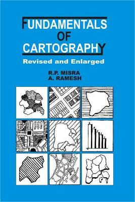
This is a new, rewritten and reorganized edition of a best selling text first published in 1973. It treats cartography as a combination of science and art, and covers the "traditional" graphic processes of map design and production. It looks at all aspects of map-making and includes topographic maps, maps for travel and recreation, nautical charts, thematic and statistical maps, and atlases. Developments in cartographic theory and research right into the second half of the 20th century are summa...
Addresses the fundamental principles of visual perception and map symbolism and critically examines the assumptions behind the theories of psychophysical testing and cartographic communication. This revised and expanded edition includes new sections on the relationship between cartography and art, and the distinction between knowledge and skill.
Neil Degrasse Tyson Snarky Coloring Book (Neil Degrasse Tyson Snarky Coloring Books, #0)
by Laura Sullivan
Notes & Comments on Composition of Terrestrial & Celestial Maps
by J.H., Tobler, Waldo Lambert
Notes and Comments on the Composition of Terrestrial and Celestial Maps is an historically significant work on modern map projections and their mathematical underpinnings. The original German edition introduced several distinct map projections still in use today and revealed the cartographic genius of author J.H. Lambert (1728-1777). In 1972, on the 200th anniversary of this seminal work, noted geographer Waldo R. Tobler published an English translation of Lambert's writings, but it has been una...
Every year, works of mapmakers from around the world are selected for the Esri Map Book to demonstrate how geographic information system (GIS) technology helps our governments, businesses, and citizens. Esri Map Book, Volume 32, continues this tradition, showcasing maps and applications that use ArcGIS to evaluate the sustainability of resources, determine efficient transportation routes, mitigate the effects of natural disasters, and much more. Each map or application incudes a description of i...
Over the past four decades, the volumes published in the landmark History of Cartography series have both chronicled and encouraged scholarship about maps and mapping practices across time and space. As the current director of the project that has produced these volumes, Matthew H. Edney has a unique vantage point for understanding what "cartography" has come to mean and include. In this book Edney disavows the term cartography, rejecting the notion that maps represent an undifferentiated cate...



![Cover of Progress Report of the Hydrometric Survey of Manitoba for the Climatic Years 1916-17, and 1917-18 [microform]](https://images.bookhype.com/covers/ba/42/94d3c4b1-6610-4d8d-9e7e-099194cd24ab/9781014970930-2778408e102b160570db40.jpg)
