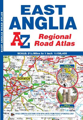
This A-Z map of East Anglia is a full colour regional road atlas featuring 39 pages of continuous road mapping that covers an area extending to:
*Grantham
*Sleaford
*Boston
*King's Lynn
*Cromer
*Great Yarmouth
*Felixstowe
*Clacton-on-Sea
*Colchester
*Chelmsford
*Harlow
*Hemel Hempstead
*Leighton Buzzard
*StamfordThis East Anglia Road Atlas is shown at a clear 2.5 miles to 1 inch scale (1.58 km to 1 cm) and includes the following features:
*Motorways open with full junction detail, motorways under construction and proposed, service areas, primary routes and destinations, A & B roads, selected minor roads, gradients 1:5 and steeper, tolls, mileages, county boundaries, spot heights and hill shading
*Selected safety camera locations with their maximum speed limits
*Selected fuel stations
*National Park boundaries
*Selected places of interest, tourist information centres and golf coursesAlso included are 14 city, town, airport or port plans for:
*Bedford
*Bury St. Edmunds
*Cambridge
*Chelmsford
*Colchester
*Ely
*Great Yarmouth
*Ipswich
*King's Lynn
*Norwich
*Luton
*Peterborough
*Harwich Port
*London Stansted AirportThe index section lists cities, towns, villages, hamlets and locations covered by this atlas.
- ISBN13 9781843487951
- Publish Date 5 November 2018
- Publish Status Active
- Publish Country GB
- Publisher HarperCollins Publishers
- Imprint Geographers' A-Z Map Co Ltd
- Edition 13th Revised edition
- Format Paperback
- Pages 60
- Language English
- URL http://collins.co.uk