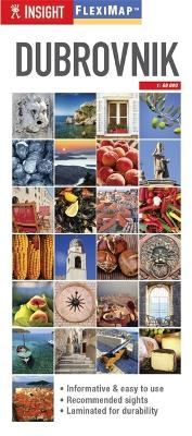
Flexi Map Dubrovnik is much more than just a laminated map. The tourist information section includes detailed descriptions and some stunning photographs of a carefully selected number of recommended sights, these sights are linked to the mapping by easy to find numbered markers. There is also an abundance of helpful information on getting around, tipping, opening times, public holidays, emergency telephone numbers and much more. The comprehensive index has been divided into different categories, such as Points of Interest, Public Buildings and Hotels, to make locating places as easy as possible. The laminated, tear-resistant finish is tough, weatherproof and can be written on using a non-permanent marker. In addition to the main city map, shown at a scale of 1:12 500 (1cm = 0.125km), there is an extremely detailed plan of the Old City of Dubrovnik and a public transport map. Two regional maps showing the North and South of Dubrovnik are also included at a scale of 1:300 000 (1cm = 3km), these are ideal for exploring slightly further afield.
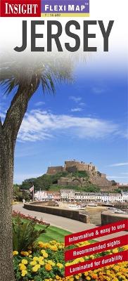
"Fleximap Jersey" is a laminated, tear-resistant map which includes 5 maps, each with individual indexes, categorized for ease of use. The main map depicts Jersey at a scale of 1:35 000, the island's topography is shown by the use of relief shading. Street plans of St Helier, St Brelade and Gorey Village are also included on which places of interest, parks, streets and selected hotels are named. An overview map of the Channel Islands and French coast shows the various ferry routes. In addition to the mapping, "Fleximap Jersey" also gives a list - with descriptions and some photographs - of 26 recommended sights, divided by theme and linked to the mapping by numbered markers. There is also a handy information section with concise details on getting around, tourist offices, money, tipping, opening times, public holidays, telecommunications, emergency telephone numbers and climate.
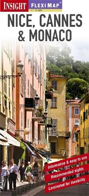
"Fleximap Nice, Cannes & Monaco" is a laminated, tear-resistant map which includes 3 individual city maps (Nice & Cannes are shown at 1:13 000 and Monaco at 1:15 000) and overview maps of the Nice area and of the Cote d'Azur. Places of interest, public buildings and selected hotels are clearly highlighted and named. Each map has a separate index which is categorised for ease of use. In addition to the mapping, "Fleximap Nice, Cannes & Monaco" also gives a list - with descriptions and some photographs - of 31 recommended sights, divided by theme and linked to the mapping by numbered markers. There is also a handy information section with concise details on getting around, tourist offices, money, tipping, opening times, public holidays, rules of the road, emergency telephone numbers and climate.
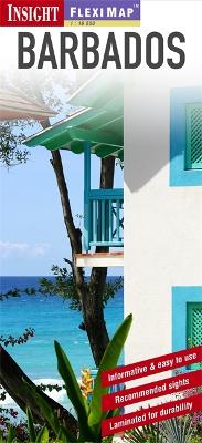
Clear, detailed mapping in 1 : 60 Th scale with comprehensive index in an easy-to-fold format. Includes maps of Bridgetown, Garrison, South and West Coast. With up to 30 Top Attractions cross-referenced to the maps to aid route-planning. Laminated, tear-proof finish for durability in high use.
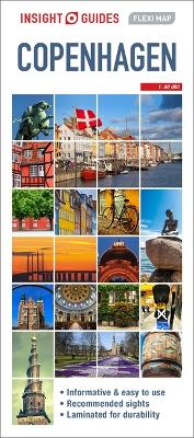
Offering a list of 23 recommended sights in Copenhagen, this title provides details on getting around, tourist offices, money, tipping, opening times, public holidays, telecommunications, emergency telephone numbers and climate.
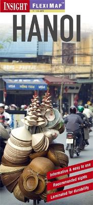
New edition. Clear, detailed mapping in 1 : 12,500 scale with symbols highlighting key points of interest including UNESCO World Heritage sites. Provides detailed maps of Hanoi and Northern Vietnam. Fully indexed and in an easy-to-fold format with write-ups for over 20 Top Attractions, cross-referenced to the maps to aid route-planning. Also includes facts for the visitor and tips for getting around. Laminated, tear-proof finish ensures durability in high use.
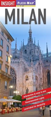
"Flexi Map Milan" is a laminated, tear-resistant map which includes 3 maps, each accompanied by its own index. The main map depicts Milan at a scale of 1:14 000 and the index has been categorized for ease of use. Streets are named along with public buildings, selected hotels and numerous places of interest. The Milan area map can be found on the reverse showing the various routes into the city by road and rail. A detailed Metro plan is located on the back cover for easy reference. Also included is a map of the wider area, which extends north to include Lake Maggiore and Lake Como. This map is shown at a scale of 1:350 000 and highlights numerous points of interest and National Parks in the region. In addition to the road and rail networks, it also provides a detailed picture of the topography through the use of relief shading with many mountain heights given. Intermediate distance indicators are given on the main routes. "Flexi Map Milan" also gives a list - with descriptions and some photographs - of 28 recommended sights, divided by theme and linked to the mapping by numbered markers. There is also a handy information section with concise details on getting around, tourist offices, money, tipping, opening times, public holidays, telecommunications, emergency telephone numbers and climate.
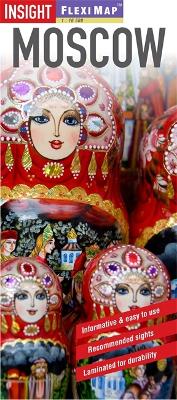
"Flexi Map Moscow" is a laminated, tear-resistant map which includes 3 maps, each accompanied by its own index. The main map depicts Moscow at a scale of 1:12 500, the index has been categorized for ease of use. Places of interest are highlighted, streets are named along with public buildings and selected hotels. The Metro system is shown on the main map and also on a dedicated plan on the back cover for easy reference. A Moscow area map, at a scale of 1:180 000, can be found on the reverse and shows the various routes into the city by road or rail. Also included is a map of the famous Golden Ring of ancient towns and sights. "Flexi Map Moscow" also gives a list - with descriptions and some photographs - of 26 recommended sights, divided by theme and linked to the mapping by numbered markers. There is also a handy information section with concise details on getting around, tourist offices, money, tipping, opening times, public holidays, telecommunications, emergency telephone numbers and climate.
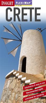
New edition of the bestselling map to Crete. Clear, detailed mapping in 1 : 225,000 scale with symbols highlighting key points of interest. Includes detailed maps of Crete East, Crete West and street plan for Heraklion. Fully indexed and in an easy-to-fold format with write-ups for 25 Top Attractions cross-referenced to the maps to aid route-planning. Also includes facts for the visitor and tips for getting around. Laminated, tear-proof finish ensures durability in high use.
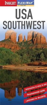
This brand new and fully-updated edition is the essential resource for your trip. Informative and easy to use; it contains digitally generated, detailed and clear cartography to a scale of 1:4 million, produced by state-of-the-art computer technology. The comprehensive index makes it extremely easy to locate all tourist attractions and facilities. The mapping is accompanied by useful travel information, detailing local transport, tourist offices and websites. It also features up to 30 illustrated recommendations of the top sights that are cross-referenced to the map, to help you set your own priorities for the trip and plan your route accordingly. A fully laminated finish means it is waterproof, hard-wearing, durable, scribble friendly and tear resistant. You can even mark your route using a non-permanent marker pen and wipe it off afterwards, to use time and time again. It is easy to fold, even in windy conditions, so it can go wherever you go!
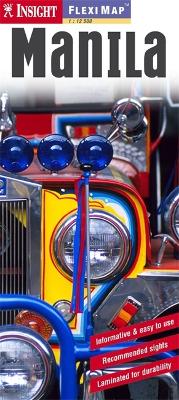
This laminated "Fleximap of Manila" contains four maps, including Manila City, Manila Region, Philippines, and an overview map of the surrounding area. It also gives overviews of the top recommended sights and places to visit, as well as practical data, climate tables and local transport details. The key features include: detailed cartography that highlights all the main tourist sites and provides valuable motoring information; informative text: essential facts about the destination are provided, plus handy tips for getting around; ease of use: the durable maps fold very easily, even when it's raining; and, laminated finish: you can write on the map with a non-permanent marker pen and wipe it off later.