Maps are essential tools for understanding the world around us. Learning to read maps - both printed and online - is a core skill that forms the basis of social studies. This book explores the different ways that maps can show information about the world.

The rich history of North Carolina's Outer Banks is reflected in the names of its towns, geographic features, and waterways. A book over twenty years in the making, The Outer Banks Gazetteer is a comprehensive reference guide to the region's place names-over 3,000 entries in all. Along the way, Roger L. Payne has cataloged an incredible history of beaches, inlets, towns and communities, islands, rivers, and even sand dunes. There are also many entries for locations that no longer exist-inlets th...
With expert mapping from the AA and Institut Geographique National (IGN), this giant scale, large format A3 atlas is very easy to read, with more than 1,000 static speed camera locations pinpointed on the mapping. Fully revised and updated for 2009, this specialist road atlas designed for the British motorist in France includes 41 city, town and port plans and a new style central Paris city plan. The coverage includes road mapping for Corsica plus there is a channel hopping guide, channel tunnel...
Atlas For Guyana Trinidad & Tobago
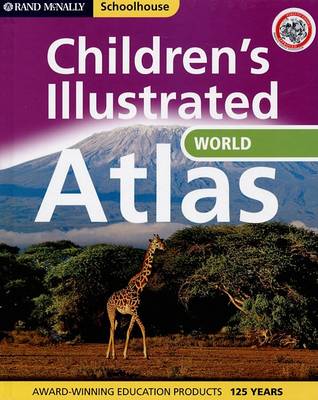
Schoolhouse Illustrated Atlas of the World (Rand McNally Schoolhouse)
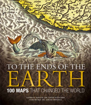
This fascinating book focuses on 100 maps that changed human understanding of the world around us, changed the course of map-making, or directly influenced the path of history. It reveals how different peoples have observed and represented their world through the ages, and how maps have been used for a variety of purposes. A team of experts address the key questions of how, why, and crucially, if, these maps have changed the world. It is illustrated with 100 of the world's most beautiful maps.
Bob Vila's Guide to Historic Homes of the Midwest and Great Plains (Bob Vila's Guides to Historic Homes of America, #4)
by Bob Vila
Philip's Road Atlas of Europe
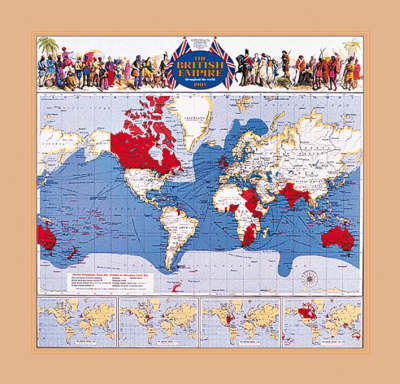
As the twentieth century dawned, the British Empire enjoyed its heyday. It spanned 11 million square miles with 400 million inhabitants. This detailed colour reproduction of a contemporary world map shows details of global trade including the furs of fox, bear, seal and otter brought from the shores of Canada's Lake Athabasca by canoes in summer and dog sleds in winter; cochineal, indigo and vanilla from central America; teak and bamboo from Siam; cinnamon and pearls from Ceylon; tortoise shells...
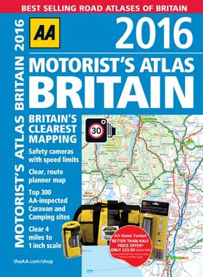
This A4 format atlas provides super-clear mapping at 4 miles to 1 inch from the experts at the AA. Each page has been titled with its geographical location so that you can turn to the page you need more easily. Static speed camera locations with speed limits are pinpointed. Wide minor roads, National Trust, English and World Heritage, crematorium locations and other hard-to-find places are also shown. Plus there are 72 city, town and port plans, a comprehensive 31,500 entry index with airports,...
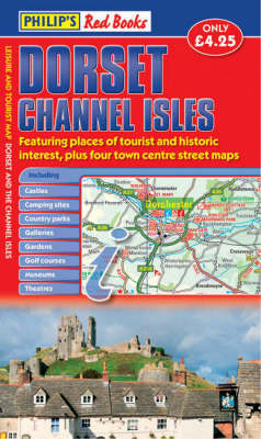
This leisure and tourist map of Dorset and the Channel Isles gives detailed coverage of the county's and islands' road networks at a scale of approximately 2.25 miles to 1 inch. It also includes town centre street maps for Bournemouth, Dorchester, Poole and Weymouth at 4 inches to 1 mile.The map shows places of tourist and historic interest, including castles, camping sites, country parks, galleries, gardens, golf courses, marinas, museums, nature trails, historic sites, sports venues, theatres,...