AA Atlases and Maps
1 total work
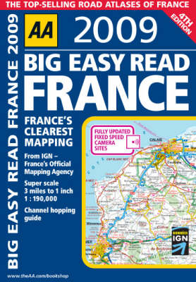
AA Big Easy Read France
Published 30 November 2008
With expert mapping from the AA and Institut Geographique National (IGN), this giant scale, large format A3 atlas is very easy to read, with more than 1,000 static speed camera locations pinpointed on the mapping. Fully revised and updated for 2009, this specialist road atlas designed for the British motorist in France includes 41 city, town and port plans and a new style central Paris city plan. The coverage includes road mapping for Corsica plus there is a channel hopping guide, channel tunnel terminal and channel tunnel port plans.