

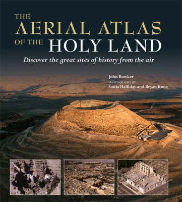
The ancient lands of Galilee, Samaria, and Judea stand at a crossroads in western and eastern history. Sites such as Jerusalem, Bethlehem, and Nazareth exert a huge pull over millions of Christian and Muslim pilgrims, and countless others who dream of making such a journey themselves - fascinated by the area's unparalleled historical and religious heritage. "The Mitchell Beazley Aerial Atlas of the Holy Land" manages to do unique justice to the beauty, mystery, and grandeur of the region. It off...
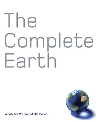
Combining the data from 18 of the most advanced Earth satellites ever built, NASA has constructed the most detailed global portrait of our planet ever created. The Complete Earth reproduces this photomap in its entirety and at full-resolution, living up to its title by revealing the whole planet, cloud-free, at a resolution of 500m to every pixel, or 90 miles to every inch. At this scale we can we can trace the Amazon from Andean headwaters to Atlantic mouth, or explore the trackless sand seas o...

Got your head in the clouds? Turn the sky into a canvas for notes, doodles, and drawings. Full of fluffy white clouds, desert sunsets, lightning storms, and early morning sunbeams, this trusty journal can be carried anywhere. The sky’s the limit!
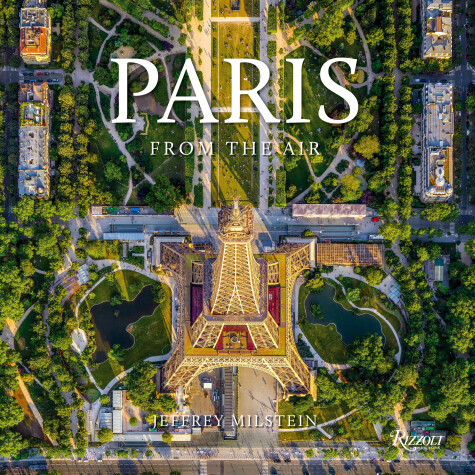
Combining daring aerial photography with the restricted airspace over Paris provides both breathtaking and unparalleled views. From sunrise to sunset, Paris is one of the most photographed cities in the world. Shooting with the newest high-resolution medium-format professional cameras while leaning out of helicopters making steep turns with the door off, Milstein captures the highly detailed, iconic, straight-down images that set his work apart. Milstein's distinctive style--straight down--lea...
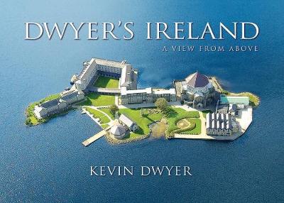
In 1989 a client asked Kevin to submit a sample aerial photograph. He had never taken any so he sent one taken from a mountaintop. The result was a commission for an aerial photograph and his first helicopter flight; his new career 'took off'. In sunny weather, Ireland is one of the most beautiful places but Kevin sometimes waited a whole summer for suitable weather to be rewarded with a day from heaven. These photographs are gathered to share the beauty of Ireland as it unfolded on various flig...
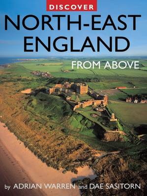
Discover North-East England from Above (Discovery Guides)
by Adrian Warren and Dae Sasitorn

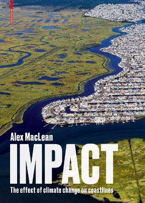
The rise in sea level is a visible and remorseless indicator of global warming, the consequences of which can be experienced worldwide - in contrast to other effects of climate change that are not yet noticeable at a larger scale. The book illustrates, in an impressive way, the ecological, commercial, and social impact associated with the rise in sea levels, taking the examples of the American East Coast and the Gulf of Mexico: the author has documented this region from his Cessna between 20...

The First World War has been described as the first total war, a conflict in which a country’s people and resources were harnessed towards final victory. During 2014-18 Historic England set out to uncover and study the physical remains left across England by the First World War. The range of what was discovered is astonishing, reflecting how the home front became as important as the battlefront. It was the place to train and equip new armies, to manufacture armaments, to treat the wounded and...