Lancaster Imprints
3 primary works
Book 19
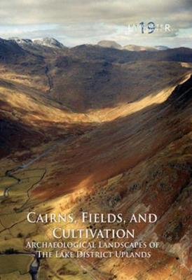
The uplands of the Lake District are famed for their rugged natural beauty, but the reality is that this landscape has been modified and changed by man since the mesolithic period. The remains for this exploitation, particularly from the Bronze Age onwards, survive in abundance across the marginal uplands, particularly in the form of cairnfields. These demonstrate how primary deforestation, creating small clearings in the wild wood, left to the development of complex settlements and field systems. The monuments also reveal the decline in the firtunes of upland settlementt during the Iron Age and Roman period, and how people responded to changes in climatic conditions on these marginal lands. In addition to the evidence for agricultural exploitation of the uplands, considerable number of funerary and ritual monuments, as well as settlements, were recorded.
This volume presents the results of a programme of detailed archaeological survey undertaken in the Lake District between 1982 and 1989, mainly on the fells above the west Cumbria coastal plain. It recorded some of the most remarkable cairnfields, field systems, and settlements in England, mostly of late prehistoric date. The project was funded by English Heritage, in conjunction was the Lake District National Park Authority, and was set up primarily to provide for the management of these landscapes, and to ensure their preservation in the future. The surveys have demonstrated that a series of nationally important archaeological landscapes survive on the marginal uplands of Cumbria, which form a palimpsest of many periods of activity, and provide a remarkable opportunity to understand the development of the land and its people.
This volume presents the results of a programme of detailed archaeological survey undertaken in the Lake District between 1982 and 1989, mainly on the fells above the west Cumbria coastal plain. It recorded some of the most remarkable cairnfields, field systems, and settlements in England, mostly of late prehistoric date. The project was funded by English Heritage, in conjunction was the Lake District National Park Authority, and was set up primarily to provide for the management of these landscapes, and to ensure their preservation in the future. The surveys have demonstrated that a series of nationally important archaeological landscapes survive on the marginal uplands of Cumbria, which form a palimpsest of many periods of activity, and provide a remarkable opportunity to understand the development of the land and its people.
Book 30
The Early Medieval Monastic Site at Dacre, Cumbria
by Rachel M. Newman, Christine Howard-Davis, and Roger H. Leech
Published 28 March 2022
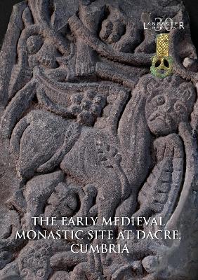
Dacre is rare in having documentary evidence for an early medieval monastery, mentioned by the Venerable Bede in 731, and in the 12th century, William of Malmesbury thought that it was where King Æthelstan of Wessex met the northern and western lords in 927. High-quality early sculptural fragments and a substantial stone drain had also been found in the 19th and early 20th centuries.
Excavations were undertaken in 1982–5, to the north and south of the parish church, and to the west of the churchyard, providing important information about its origins. A substantial early medieval cemetery of more than 200 graves was found to the north, with some burials in chests with iron fittings. Two structures were excavated to the west of this, one, with a rounded eastern end, containing a hearth made from a millstone. This was associated with a substantial assemblage of fine metalwork, loomweights, and vessel and window glass,
and several Northumbrian coins were also found. The drain in the southern churchyard was re-excavated, demonstrating that it was constructed of reused Roman stones, probably from a bridge or mill. An early ditched boundary was also identified, circling the south and west sides of the medieval churchyard, which seems to have followed its line.
The early cemetery was later partially covered by a medieval farmstead, consisting of at least three buildings, one with a well-made fireplace. This had become derelict by the 15th/16th century, when the village either shrank or moved to the west, leaving the site very much as it is today.
Book 31
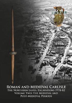
Carlisle City Council redeveloped the Lanes from the mid-1970s, a densely built-up area in the north-east corner of the city’s historic core, crossed by 19 narrow ‘vennels’. These, together with most of the adjacent buildings, were swept away by the construction of the Lanes shopping centre. Previous archaeological work had confirmed complex Roman and medieval deposits on the site, most of which would be destroyed by the development, and many of the buildings were of historical and architectural interest. A programme of archaeological and historical investigation, including building recording, was therefore undertaken, principally funded by Carlisle City Council, the Department of the Environment (now Historic England), and the Manpower Services Commission, completed between 1978 and 1982. Historic England also funded the post-excavation analysis and this publication. The Lanes remains one of the largest and most significant archaeological projects ever undertaken in northern England.
The project was split into the northern and southern Lanes, the results of the latter being published in 2000, though it only included a summary of the standing-building survey. This volume, the companion to the 2019 publication of the Roman remains at the northern site, presents the evidence for post-Roman activity. The site appears to have been abandoned by the fifth century, layers of ‘dark earth’ accumulating over the latest Roman levels. Several decades after Carlisle was re-established by William II, narrow burgage plots were created, extending from Scotch Street to the recently constructed city wall. These were intensively occupied from then on and yielded a wealth of evidence for the everyday lives of the inhabitants. Around the mid-thirteenth century, the lanes themselves were created between these plots, probably to improve access, and this distinctive pattern of land-use persisted until the modern redevelopment.
The project was split into the northern and southern Lanes, the results of the latter being published in 2000, though it only included a summary of the standing-building survey. This volume, the companion to the 2019 publication of the Roman remains at the northern site, presents the evidence for post-Roman activity. The site appears to have been abandoned by the fifth century, layers of ‘dark earth’ accumulating over the latest Roman levels. Several decades after Carlisle was re-established by William II, narrow burgage plots were created, extending from Scotch Street to the recently constructed city wall. These were intensively occupied from then on and yielded a wealth of evidence for the everyday lives of the inhabitants. Around the mid-thirteenth century, the lanes themselves were created between these plots, probably to improve access, and this distinctive pattern of land-use persisted until the modern redevelopment.