Scottish Burgh Survey
6 total works
Historic Barrhead
by E Patricia Dennison, Simon Stronach, and Russel Coleman
Published 29 April 2008
This survey provides an accessible and broad-ranging synthesis of existing knowledge on historic Barrhead, and will inform conservation guidance for future development. The historic town of Barrhead is situated to the west of Glasgow in East Renfrewshire. Barrhead was created in the late 18th century and grew rapidly because it was in the right place at the right time. It was close to the emerging commercial centres of Glasgow and Paisley and could rely on the Levern Water to power a booming textile industry. The valley in which the town grew also has a rich earlier history. The book identifies medieval sites and charts the development of the town from the scatter of fermtouns shown on early maps and goes on to sketch the social history of a community shaped by the industrial revolution. Barrhead was elevated to the status of a burgh in 1893. Although the textile industry was in decline by this time, the lost jobs were replaced by heavy industries. The authors look at the history and archaeological potential of key sites in the town, to inform the future management of Barrhead's heritage.
Historic Maybole
by E Patricia Dennison, Dennis Gallagher, and Gordon Ewart
Published 18 October 2005
The historic town of Maybole lies equidistant from the burghs of Ayr and Girvan in South Ayrshire. The development of the medieval town was influenced by the tempestuous history of local rivalries and feuds - encouraging the building of substantial defensible townhouses, of which the castle and the tolbooth survive today, as well as a distinctive urban defensible townhouse that had been hidden beneath later remodelling. There are other glimpes of earlier remains and evidence of settlement patterns in the eighteenth and nineteenth-century townhouses in the heart of the town and in the burgage plots either side of the High Street. The core of earlier medieval settlement lies around the collegiate church and old kirkyard, as well as the site of the original church in Maybole, The volume also traces the industrial growth and thriving economic life of nineteenth-century Maybole, with new civic building, factory developments and residential expansion. The rapid changes of the last century are fully explored, and an evaluation made about the surviving evidence.
The authors look at the archaeological potential of key sites in the town, to both direct more detailed research and help protect Maybole's heritage. This survey provides an accessible and broad-ranging synthesis of existing knowledge on historic Maybole, as well as offering invaluable guidance for planners. The book is part of the Scottish burgh survey - a series designed to identify which areas of Scotland's historic burghs are of archaeological interest.
The authors look at the archaeological potential of key sites in the town, to both direct more detailed research and help protect Maybole's heritage. This survey provides an accessible and broad-ranging synthesis of existing knowledge on historic Maybole, as well as offering invaluable guidance for planners. The book is part of the Scottish burgh survey - a series designed to identify which areas of Scotland's historic burghs are of archaeological interest.
Historic Kirkintilloch
by Martin Rorke, E Patricia Dennison, Simon Stronach, and Russel Coleman
Published 31 December 2009
This survey offers an accessible and broad-ranging synthesis of the history and archaeology of Kirkintilloch, Dunbartonshire, and aims to inform conservation guidance for future development. Kirkintilloch lies at a key point in Scotlands central belt. Here, by accident of geography, the Antonine Wall, ancient and modern route ways and the Forth and Clyde Canal pass within yards of each other. Here also, iron founding was added to the linen and cotton weaving industry giving Kirkintilloch an important role in Scotlands nineteenth-century economic development. The town has benefited from archaeological investigations in advance of development, and those designed to enhance our knowledge of the Antonine Wall. The authors consider where the areas of archaeological potential lie, in order to inform future management of Kirkintillochs historic environment, and pose questions about the evolution of Scotlands burghs.
Charts the developemt of the historic town of Kilsyth from the scatter of ferm touns in the area in the late 1500s, through to the elevation of Kilsyth to a burgh of barony in 1620 and the subsequent expansion of the 'new town', serving as a market and a centre of the textile industry. Part of the Scottish Burgh Survey - a series designed to identify the archaeological potential of Scotland's historic towns.
Historic Galashiels
by Martin Rorke, E Patricia Dennison, and Dennis Gallagher
Published 16 June 2011
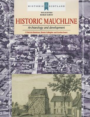
Historic Mauchline
by E Patricia Dennison, Dennis Gallagher, and Gordon Ewart
Published 3 December 2006
Mauchline lies in the foothills of the western slopes of the Southern Uplands, 16km east of Ayr and 13km south of Kilmarnock. Mauchline was the administrative centre of the regality of Kylesmuir, granted in the twelfth century to Melrose Abbey. It was erected as a burgh of barony in 1510 and a burgh of regality in 1707. The town was noted for its trade in livestock and, in the nineteenth century, for textile manufacture, the leather industry, and the manufacture of wooden snuff and souvenir boxes. The close association of Mauchline and the poet Robert Burns generated a tourist industry, helped after 1850 with the arrival of rail transport. This book is part of the Scottish Burgh Survey - a series designed to identify the archaeological potential of Scotland's historic towns.
