National Trail Guide
1 total work
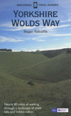
The Yorkshire Wolds Way is the 79-mile National Trail over the gently rolling chalk hills between Hessle Haven and the cliffs above Filey. Beginning by the Humber estuary you can follow the Countryside Agency's acorn waymarks through wooded slopes and valleys, past the deserted medieval village of Wharram Percy to the geological curiosity of Filey Brigg. This is the complete, official guide for the long-distance walker or the weekend stroller. The book contains: the entire route, split into convenient sections; 1:25,000 Ordnance Survey maps for each section, marked with points of special interest; circular routes off the trail for shorter walks, enabling the walker to explore the local area; route information on each section, with colour photographs and notes on nearby features; background information on local history, wildlife, archaeology, geology, industry and land use; details of public transport, villages on or near the route with facilities for walkers, useful organisations and sources of further information on accommodation; and the Countryside Access Charter on your rights and responsibilities when out in the countryside.