Iolaire
1 primary work • 6 total works
Book 231
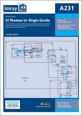
Plans included: Charlotte Amalie (St Thomas) (1:30,000) Cruz Bay (St John) (1:20,000) Road Harbour, Sea Cow Bay & Nanny Cay Marina (Tortola) (1:20,000) Benner Bay (St Thomas) (1:20,000) Great Camanoe to Scrub Island (1:20,000) On this 2016 edition the latest depth surveys have been applied. The latest information on the works to extend Nanny Cay Marina are included. The chart specification has been improved to show coloured light flashes. There has been general updating throughout.
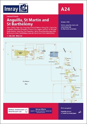
Plans included: Prickly Pear Cays (1:30,000) Shoal Bay & Island Harbour (Anguilla) (1:50,000) Crocus Bay (Anguilla) (1:15,000) Road Bay (Anguilla) (1:12,000) Simpson Bay Lagoon and Baie de Marigot (Saint Martin) (1:30,000) Great Bay (Sint Maartin) (1:15,000) Oyster Pond (Sint Maartin) (1:10,000) Port de Gustavia (Saint Barthelemy) (1:15,000) Anse de Marigot (Saint Barthelemy) (1:30,000)
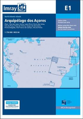
On this 2016 edition the latest depth surveys have been applied. New Marine Reserves are shown where appropriate as are new submarine cables. Completed harbour development is now shown on the Porto das Velas plan as are the current works in progress. There has been general updating throughout. Plans included: Vila das Lajes (1:20 000) Horta (1:12 500) Lajes (Pico) (1:10 000) Porto das Velas (1:7500) Vila da Praia (1:10 000) Praia da Vitoria (1:20 000) Angra do Heroismo (1:12 500) Ponta Delgada (1:10 000) Vila Franco do Campo (1:15 000) Vila do Porto (1:10 000)