A review of five major categories of lithogenetic and morphogenetic terrain types meet the complex terrain criteria: landslides, field photos of slope failures, bedrocks, nonglacial surficial deposits, glacial and alpine-glacial, and periglacial. Interpretations are based on personal knowledge and available background materials. This monograph documents a concept of complex terrains with the use of 208 illustrations, including 64 analyzed and extensively commented examples of stereo-pair air pho...
Encyclopedic Atlas of Terrestrial Impact Craters
This comprehensive atlas explains the genesis and evolution of impact known craters on Earth, presenting a wealth of radar images from the Italian COSMO-SkyMed satellites that were acquired at the same frequency, spatial resolution, operating mode, and illumination, allowing excellent comparison of different impact structures. It also discusses in detail the processes that have hidden or erased terrestrial impact craters, and clearly explains the basic principles of remote sensing and the COSMO-...
Extraterrestrial Influence on Climate Change (SpringerBriefs in Environmental Science)
by Saumitra Mukherjee
Climate change has been addressed since last decade based on the influence of human activities like production of industrial effluents, land use changes and other activities due to development of the society. These are very important issues no doubt but the activities due to the influence of extraterrestrial phenomena have not been given its due importance. An attempt is being made here to understand the influence of extraterrestrial activities as one of the important factors of climate change h...
Remote Sensing Advances for Earth System Science (SpringerBriefs in Earth System Sciences)
by Diego Fernandez-Prieto and Roberto Sabia
To better understand the various processes and interactions that govern the Earth system and to determine whether recent human-induced changes could ultimately de-stabilise its dynamics, both natural system variability and the consequences of human activities have to be observed and quantified. In this context, the European Space Agency (ESA) published in 2006 the document “The Changing Earth: New Scientific Challenges for ESA's Living Planet Programme” as the main driver of ESA’s new Earth Obs...
Thermal Infrared Remote Sensing (Remote Sensing and Digital Image Processing, #17)
This book provides a comprehensive overview of the state of the art in the field of thermal infrared remote sensing. Temperature is one of the most important physical environmental variables monitored by earth observing remote sensing systems. Temperature ranges define the boundaries of habitats on our planet. Thermal hazards endanger our resources and well-being. In this book renowned international experts have contributed chapters on currently available thermal sensors as well as innovative pl...
This book gives a comprehensive view of the developed procrustes models, including the isotropic, the generalized and the anisotropic variants. These represent original tools to perform, among others, the bundle block adjustment and the global registration of multiple 3D LiDAR point clouds. Moreover, the book also reports the recently derived total least squares solution of the anisotropic Procrustes model, together with its practical application in solving the exterior orientation of one image....
Issues in the Impacts of Climate Variability and Change on Agriculture
This book presents a collection of articles concerning key topics which examine the impacts of climate change and variability on agriculture. The application region is the southeastern United States. The main topics include an investigation of the effect of variations in the spatial scale of climate change scenarios on an agricultural integrated assessment, methods of simulating adaptations of climate change, and the relationship between large scale climate variability and local climate and vege...
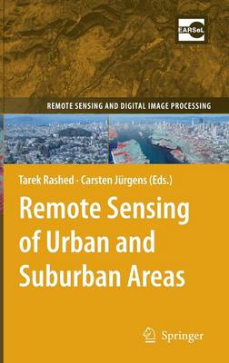
Remote Sensing of Urban and Suburban Areas (Remote Sensing and Digital Image Processing, #10)
"Remote Sensing of Urban and Suburban Areas" provides instructors with a text reference that has a logical and easy-to-follow flow of topics around which they can structure the syllabi of their urban remote sensing courses. Topics have been chosen to bridge the gap between remote sensing and urban studies through a better understanding of the science that underlies both fields. In so doing, the book includes 17 chapters written by leading international experts in respected fields to provide a ba...
Progress in Geospatial Analysis
This book examines current trends and developments in the methods and applications of geospatial analysis and highlights future development prospects. It provides a comprehensive discussion of remote sensing- and geographical information system (GIS)-based data processing techniques, current practices, theories, models, and applications of geospatial analysis. Data acquisition and processing techniques such as remote sensing image selections, classifications, accuracy assessments, models of GIS...
This book chronicles the decades-long work of studying, analyzing, and reversing the environmental pressures that threatened India’s Chilika Lagoon, the largest brackish-water lagoon in the region, and the second largest in the world. Designated as one of India’s first Ramsar Sites in 1981, Chilika Lagoon continued to degrade for a decade longer. Then, the Chilika Development Authority (CDA) was established to gather information and devise a restoration plan that benefits the ecosystems of the l...
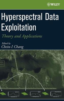
Hyperspectral Data Exploitation
Authored by a panel of experts in the field, this book focuses on hyperspectral image analysis, systems, and applications. With discussion of application-based projects and case studies, this professional reference will bring you up-to-date on this pervasive technology, wether you are working in the military and defense fields, or in remote sensing technology, geoscience, or agriculture.
Land Cover Change and Its Eco-environmental Responses in Nepal (Springer Geography)
This book offers a systematic investigation of the ecological and environmental issues related to the land cover changes in Nepal by researchers from both China and Nepal. It discusses the eco-environmental issues faced by Nepal, particularly in the hills and mountain regions. It also sheds light on the global concerns regarding the eco-environment issues of mountains, and analyzes the various causes and potential consequences of eco-environmental degradation in Nepal. The book is of particular...
Geographical Design (Synthesis Lectures on Human-Centered Informatics)
by Stephen Hirtle
With GIS technologies ranging from Google Maps and Google Earth to the use of smart phones and in-car navigation systems, spatial knowledge is often acquired and communicated through geographic information technologies. This monograph describes the interplay between spatial cognition research and use of spatial interfaces. It begins by reviewing what is known about how humans process spatial concepts and then moves on to discuss how interfaces can be improved to take advantage of those capabilit...
Subsurface-Water Hydrology (Water Science and Technology Library, #16)
Water is vital to life, maintenance of ecological balance, economic development, and sustenance of civilization. Planning and management of water resources and its optimal use are a matter of urgency for most countries of the world, and even more so for India with a huge population. Growing population and expanding economic activities exert increasing demands on water for varied needs--domestic, industrial, agricultural, power generation, navigation, recreation, etc. In India, agriculture is the...
Cellular V2X for Connected Automated Driving
by Mikael Fallgren, Markus Dillinger, Toktam Mahmoodi, and Tommy Svensson
CELLULAR V2X FOR CONNECTED AUTOMATED DRIVING A unique examination of cellular communication technologies for connected automated driving, combining expert insights from telecom and automotive industries as well as technical and scientific knowledge from industry and academia Cellular vehicle-to-everything (C-V2X) technologies enable vehicles to communicate both with the network, with each other, and with other road users using reliable, responsive, secure, and high-capacity communication links....
There has been an increasing demand in GIS for systems that support historical data: time-series data as well as mobility information. From a modelling perspective, there are advantages in integrating object-oriented analysis and design to databases as well as to visualisation capabilities of GIS.Object-Oriented Design for Temporal GIS explores
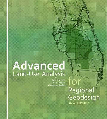
Advanced Land-Use Analysis for Regional Geodesign
by Paul D. Zwick, Iris E. Patten, and Abdulnaser Arafat
Advanced Land-Use Analysis for Regional Geodesign: Using LUCISplus is the follow-up book to Smart Land-Use Analysis: The LUCIS Model (Esri Press 2007). Both are important works in the growing field of geodesign and smart land-use planning. This book, like its predecessor, shows how geographic information systems (GIS) software and technology are used to analyze land-use suitability, stakeholder preferences, and conflicts between competing land interests. Topics include the transportation/land-u...
Remote Sensing of the Ocean, Sea Ice, Coastal Waters, and Large Water Regions 2015 (Proceedings of SPIE)
Proceedings of SPIE present the original research papers presented at SPIE conferences and other high-quality conferences in the broad-ranging fields of optics and photonics. These books provide prompt access to the latest innovations in research and technology in their respective fields. Proceedings of SPIE are among the most cited references in patent literature.
Principles of Applied Remote Sensing
by Siamak Khorram, Cynthia F. van der Wiele, Frank H. Koch, Stacy A. C. Nelson, and Matthew D. Potts
This textbook is one of the first to explain the fundamentals and applications of remote sensing at both undergraduate and graduate levels. Topics include definitions and a brief history of payloads and platforms, data acquisition and specifications, image processing techniques, data integration and spatial modeling, and a range of applications covering terrestrial, atmospheric, oceanographic and planetary disciplines. The policy and law issues of remote sensing and the future trends on the hori...
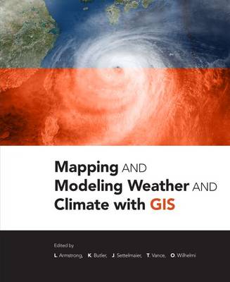
Mapping and Modeling Weather and Climate with GIS
Mapping and Modeling Weather and Climate with GIS is a contributed volume of 23 chapters from leading climatologists, meteorologists, and other experts about how geospatial cartography and analysis helps to advance atmospheric science research. Coverage includes data and software resources, data representation, observations, modelling, data-model integration, web services, and the areas of current and potential cross-fertilization of atmospheric and geospatial sciences. Providing both the conce...
The fusion of basic ideas in mathematics, biology, and chemistry with ongoing improvements in hardware and computation offers the promise of much more sophisticated and accurate sensing capabilities than currently exist. Coupled with the dramatic rise in the need for surveillance in innumerable aspects of our daily lives, brought about by hostile acts deemed unimaginable only a few short years ago, the time is ripe for scientists in the diverse areas of sensing and security to join together in a...
Sustainable Urbanism in Developing Countries
1 Investigates the interdisciplinary approach in urbanism including urban ecology, ecosystem services, sustainable landscapes, and advanced geographical systems. 2 Analyses unique case studies of rapid urbanization, from local to national scale, in countries like India, Sri Lanka, China, Bangladesh, Malaysia, and Indonesia, and their global impact. 3 Examine the use of GIS and spatial statistics in analyzing urban sprawl and the massive amount of data gathered by every operational activity of mu...
