Can any hobbyist build a satellite? Our DIY guide steps you through designing and building a base picosatellite platform tough enough to withstand launch and survive in orbit. If you have basic maker skills, you can build a space-ready solar-powered computer-controlled assembly suitable for attaching instruments and rocketing into space.
International Geoscience and Remote Sensing Symposium
The theme of the GRSS '98 emphasizes the role of remote sensing for managing limited natural resources. It covers topics such as: applications of remote sensing; electromagnetic problems; data processing techniques; geophysical models; and techniques and instrumentation.
Image and Signal Processing for Remote Sensing XXI (Proceedings of SPIE)
Proceedings of SPIE present the original research papers presented at SPIE conferences and other high-quality conferences in the broad-ranging fields of optics and photonics. These books provide prompt access to the latest innovations in research and technology in their respective fields. Proceedings of SPIE are among the most cited references in patent literature.
Remote Sensing and Modeling; Advances in Coastal and Marine Resources (Coastal Research Library, #9)
This book is geared for advanced level research in the general subject area of remote sensing and modeling as they apply to the coastal marine environment. The various chapters focus on the latest scientific and technical advances in the service of better understanding coastal marine environments for their care, conservation and management. Chapters specifically deal with advances in remote sensing coastal classifications, environmental monitoring, digital ocean technological advances, geophysic...
Space Remote Sensing of Subtropical Oceans (Srsso) (Cospar, #8) (Cospar Colloquia)
by Cho-Teng Liu
This volume contains the proceedings from the COSPAR Colloquium on "Space Remote Sensing of Subtropical Oceans" which took place between 12 and 16 September, 1996, at the Institute of Oceanography of the National Taiwan University. Included are contributions addressing the issue, from scientific points of views, of why the first scientific satellite of Taiwan, ROCSAT-1, should be equipped with the Ocean Colour Imager (OCI) for oceanographic investigations.
Geospatial Techniques for Managing Environmental Resources
"Geospatial Information" is spatial data concerning a place or, in space, collected in real time. Geospatial techniques together with remote sensing, geographic information science, Global Positioning System (GPS), cartography, geovisualization, and spatial statistics are being used to capture, store, manipulate and analyze to understand complex situations to solve mysteries of the universe. These techniques have been applied in various fields such as meteorology, forestry, environmental managem...
Mapping the Nation
Mapping the Nation: Governments Coordinated Responses to Crises continues the pattern of annual national mapping books from Esri that highlight inspiring GIS work by the public sector. This year, this book focuses on the many ways GIS can help governments in times of crisis. These stories highlight how GIS was applied during the COVID-19 pandemic with a focus on how the public sector uses GIS to serve all people. Mapping the Nation: Governments Coordinated Responses to Crises details how GIS hel...
Human Resources and Crew Resource Management
The TransNav 2011 Symposium held at the Gdynia Maritime University, Poland in June 2011 has brought together a wide range of participants from all over the world. The program has offered a variety of contributions, allowing to look at many aspects of the navigational safety from various different points of view. Topics presented and discussed at the Symposium were: navigation, safety at sea, sea transportation, education of navigators and simulator-based training, sea traffic engineering, ship's...
By 2020, experts forecast that up to 28 billion devices will be connected to the Internet, with only one third of them being computers, smartphones, smartwatches, and tablets. The remaining two thirds will be other "devices" - sensors, terminals, household appliances, thermostats, televisions, automobiles, production machinery, urban infrastructure and many other "things", which traditionally have not been Internet enabled. This "Internet of Things" (IoT) represents a remarkable transformation...
The Kingston University GIS Distance Learning Pack
Discover the principles and techniques of remote sensing with polarimetric radar This book presents the principles central to understanding polarized wave transmission, scattering, and reception in communication systems and polarimetric and non-polarimetric radar. Readers gain new insight into the methods for remotely gathering data about the earth's surface and atmosphere with polarimetric synthetic-aperture radar and polarimetric interferometry, including the changes that take place with seaso...
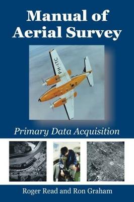
Primary data acquisition is the front end of mapping, GIS and remote sensing and involves: aviation, navigation, photography, cameras (film and digital systems), GPS systems, surveying (ground control), photogrammetry and computerized systems.This book deals with differential GPS systems, survey flight management systems (both simple and sophisticated), film types, modern film survey cameras such as LH RC-30, Z/I RMK-TOP, digital cameras, infrared methods, laser profilers, airborne laser mapping...
Environmental Change in South Asia
Studies on South Asia are an emerging interdisciplinary field, this volume expands on the currently limited literature available on South Asia and focuses on the regions environmental, climatic and natural resource base by looking at case studies from Nepal, India and Bangladesh. The book contains twelve chapters which deal with various environmental challenges, such as the impacts of climate change on floods and droughts, population structure and regeneration dynamics of dominant treeline spec...
Geomatics Solutions for Disaster Management (Lecture Notes in Geoinformation and Cartography)
Natural and anthropogenic disasters have caused a large number of victims and significant social and economic losses in the last few years. There is no doubt that the risk prevention and disaster management sector needs drastic measures and improvements in order to decrease damage and save lives of inhabitants. Effective utilization of satellite positioning, remote sensing, and GIS in disaster monitoring and management requires research and development in numerous areas: data collection, access...
The elasmobranch fishes include the living sharks, skates and rays that are important members of nearly all marine ecosystems. Their large size, secretive behavior, and wide-ranging habits make them difficult to observe in the field or to maintain in captivity. Consequently, little is known about their natural behavior and how it is mediated by their sensory systems. This volume is dedicated to the scientific contributions and memory of Donald Nelson, a pioneer in the study of shark behav...
Geospatial Technologies and Homeland Security (GeoJournal Library, #94)
Homeland security and context In the Geographical Dimensions of Terrorism (GDOT) (Cutter et al. 2003), the first book after 9/11 to address homeland security and geography, we developed several thematic research agendas and explored intersections between geographic research and the importance of context, both geographical and political, in relationship to the concepts of terrorism and security. It is good to see that a great deal of new thought and research continues to flow from that initial re...
Remote Sensing of the African Seas
The African Seas include marginal basins of two major oceans, the Atlantic and the Indian, a miniature ocean, the Mediterranean Sea, and an infant ocean, the Red Sea. Understanding the wide spectrum of environmental features and processes of such a varied collection of marine and coastal regions requires that in situ observation systems be integrated and actually guided, by the application of orbital remote sensing techniques. This volume reviews the current potential of Earth Observations to he...
Auf dem ganzen Erdball drängen die Menschen vom Land in die Städte. Den prognostizierten globalen Bevölkerungszuwachs werden komplett die Städte auffangen. Mit dieser gewaltigen Wanderungsbewegung gehen dramatische Veränderungen der globalen Siedlungslandschaft einher: Neue Millionenstädte entstehen aus dem Nichts, Slums wuchern in jede noch so kleine städtische Freifläche, Megacities fressen sich unaufhaltsam ins Hinterland. Vorstädte erstrecken sich ins Unendliche, Städte verschmelzen miteinan...
Imaging Spectrometry -- a Tool for Environmental Observations (Eurocourses: Remote Sensing, #4)
The technique of imaging spectrometry has now passed its infancy and entered into a new phase of application oriented research. Advanced sensor systems (such as Nasa/JPL's AVIRIS) have become available for international research programmes (MAC Europe 1991), new imaging spectrometers are under development in several European countries or have already passed their acceptance tests, and first high spectral resolution imaging systems are already operated by private industry. On European level, the...
Cartography - The Way Ahead
This book constitutes the refereed proceedings of the 16th International Symposium on Web and Wireless Geographical Information Systems, W2GIS 2018, held in A Coruña, Spain, in May 2018. The 15 full papers included in the volume were carefully reviewed and selected from 20 submissions. They deal with theoretical, technical, and practical issues in the field of wireless and Internet technologies suited for the dissemination, usage, and processing of geo-referenced data.
Hurricane Monitoring With Spaceborne Synthetic Aperture Radar (Springer Natural Hazards)
This book discusses in detail the science and morphology of powerful hurricane detection systems. It broadly addresses new approaches to monitoring hazards using freely available images from the European Space Agency’s (ESA’s) Sentinel-1 SAR satellite and benchmarks a new interdisciplinary field at the interface between oceanography, meteorology and remote sensing. Following the launch of the first European Space Agency (ESA) operational synthetic aperture radar satellite, Sentinel-1, in 2014, s...
