ESRI Arcgis Desktop Associate Certification Study Guide
by Brittney White
Civil Engineering Applications of Remote Sensing and Geographic Information Systems
Military Remote Sensing (Proceedings of SPIE)
Proceedings of SPIE present the original research papers presented at SPIE conferences and other high-quality conferences in the broad-ranging fields of optics and photonics. These books provide prompt access to the latest innovations in research and technology in their respective fields. Proceedings of SPIE are among the most cited references in patent literature.
Getting to Know Desktop GIS
Socio-Economic Applications of Geographic Information Science (Innovations in GIS)
To date, no one volume in the Innovations in GIS series has been given over to solely highlighting the use of up-to-date GIS-based techniques in a range of socio-economic applications. This monograph redresses this gap. The book begins with a short introductory chapter on the fundamental principles of GIS, followed by an examination of recent innovative research in the areas of crime applications, planning, urban and rural policy, and finally the use of GIS to examine various aspects of socio-ec...
Contributed articles in honor of Yola Verhasselt, b. 1937, professor of Geography, Free University, Brussels.
This book has been written for non-mathematicians who need to understand some of the assumptions that underlie the manipulation and display of geographic information. It assumes very little basic knowledge of mathematics but moves rapidly through a wide range of data transformations, outlining the techniques involved. Many of these are precise, building logically from certain underlying assumptions; others are based on statistical analysis and the pursuit of the optimum rather than the perfect,...
Oceanography and Marine Environment in the Basque Country (Elsevier Oceanography, #70)
by A Borja
Against a background of extensive multi-disciplinary oceanographic investigations over a number of years, together with the long-term establishment of a Society and Institute, extensive information is available from studies undertaken in the estuarine and coastal waters of the Basque Country. The present authors gained access to unpublished literature and reports which, together with a synthesis of internationally-refereed papers, provide a series of scientific overviews of particular subject a...
(wcs)Remote Sensing 5th Edition with Study Tips Set
by Thomas Lillesand
Innovations In GIS (Innovations in GIS)
This book aims to offer research at the cutting edge. The individual chapters are fully revised and updated versions of contributions to the first focused scientific symposium on research in geographic information systems GISRUK. The book provides the reader with a comprehensive outline of the full range and diversity of innovative research programmes in the science of GIS. Chapters address key issues such as computational support; spatial analysis and error; and application and implementation.
Quantitative Methods and Applications in GIS integrates GIS, spatial analysis, and quantitative methods to address various issues in socioeconomic studies and public policy. Methods range from basic regression analysis to advanced topics such as linear programming and system of equations. Applications vary from typical themes in urban and regional analysis - trade area analysis, accessibility measures, analysis of regional growth patterns, land use simulation - to issues related to crime and hea...
Image and Signal Processing for Remote Sensing (Proceedings of SPIE, v. 3500)
Linked Data opens up structured data from databases to be searched and queried via the web, and a geographic element is increasingly being used to link to those data. This book helps you understand how to organize and describe data that includes geographic content and how to publish it as Linked Data for the Semantic Web, as well as explaining the benefits of doing so. In easy-to-understand terms, it equips you with the knowledge you need to think about Geographic Information through the lens of...
International Study on Cost-Effective Earth Observation Missions
It is within the means of many nations to conduct or participate in cost-effective Earth observation missions. This study provides a definition of cost-effective Earth observation missions and information about background material and organizational support. It discusses cost drivers and provides advice on achieving cost-effective missions and discusses training and education. The conclusions and recommendations range from more general factors, which drive the small satellite mission activities,...
Space Science and Communication for Sustainability
This book addresses space science and communication - one of the main pillars of space science sustainability, an area that has recently become of great importance. In this regard, research and development play a crucial role in sustainability development. However, obtaining essential data in the physical world to interpret the universe and to predict what could happen in the future is a challenging undertaking. Accordingly, providing valid information to understand trends, evaluate needs, and c...
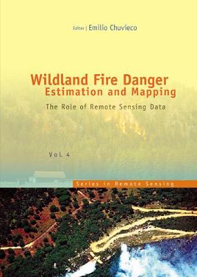
The book presents a wide range of techniques for extracting information from satellite remote sensing images in forest fire danger assessment. It covers the main concepts involved in fire danger rating, and analyses the inputs derived from remotely sensed data for mapping fire danger at both the local and global scale. The questions addressed concern the estimation of fuel moisture content, the description of fuel structural properties, the estimation of meteorological danger indices, the analys...
Lidar Sounding Clouds Aerosols (Cambridge Atmospheric and Space Science)
by Platt
So much of what is commonplace today was once considered impossible, or at least wishful thinking. Laser beams in the operating room, cars with built-in guidance systems, cell phones with email access. There's just no getting around the fact that technology always has, and always will be, very cool. But technology isn't only cool; it's also very smart. That's why one of the hottest technological trends nowadays is the creation of smart homes. At an increasing rate, people are turning their hom...
Geographic Information Systems in Law Enforcement, Criminal Investigation, and Counterterrorism: Second Edition features 100 new pages of text that broaden the scope of GIS uses into forensics and homeland security. This edition discusses crime scene related issues tying GIS to forensics. It presents material on geographic profiling and serial killers, analyzing spatial patterns for stationary and traveling killers. With 8 pages of color maps, it includes new high profile cases that show how suc...


