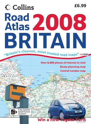
Scale: 4 miles to 1 inch.
Large format road atlas of Britain complete with a range of town centre plans.
Detailed road maps of the whole of Great Britain accompanied by a range of town and city centre street plans. The large page format makes the atlas particularly easy to use as a large section of the journey can been seen at one time.
Road maps include:
Fixed speed camera locations.
Average speed cameras highlighted.
Wide range of places of tourist interest.
Ferry routes.
Park and Ride locations.
Administrative boundaries.
Toll roads.
Seaside destinations.
Surfing beaches.
Blue flag beaches.Range of street maps included in the atlas:
Aberdeen, Birmingham, Bradford, Brighton, Bristol, Cardiff, Coventry, Derby, Edinburgh, Exeter, Glasgow, Hull, Leeds, Leicester, Liverpool, London, Manchester, Newcastle upon Tyne, Nottingham, Plymouth, Portsmouth, Sheffield, Southampton, Stoke-on-Trent and York.There is also a route planning map of Ireland at 17.5 miles to 1 inch with city centre plans of Belfast and Dublin.
- ISBN13 9780007795246
- Publish Date 6 August 2007
- Publish Status Out of Print
- Out of Print 19 March 2021
- Publish Country GB
- Publisher HarperCollins Publishers
- Imprint Collins
- Edition New edition
- Format Paperback
- Pages 96
- Language English
- URL http://collins.co.uk
