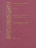
The ancient site of Xochicalco is located in the state of Morelos in the southern reaches of the central Mexican mountain range. Two hundred years ago it was the first archaeological site in Mexico to be "scientifically" described, but archaeologists have since disagreed on practically every aspect of its history and function. It has been characterized as a Maya colony, a commercial entrept controlling interregional trade routes, a religious shrine and pilgrimage center for the cult of Quetzalcoatal, and even the location of Tamoanchan, the paradise of Nahuatl mythology. Seeking answers, the Xochicalco Mapping Project was initiated in 1978. Specific goals were to locate the site's physical boundaries and identify itsresidential area; map and establish the size of Xochicalco during its major developmental periods; analyze the site's residential and public architecture to provide clues for sociopolitical organization; and obtain data for insight into Xochicalco's role in the regional evolution of social, economic, and political systems.. The two volumes in this series present data and analysis from twenty years of research. Volume 1 offers a specific analysis of Xochicalco urban development plus a synthetic treatment of culture process in central Mexico. Volume 2 includes descriptive and synthetic contributions. It contains much of the data referred to in volume 1, though primarily in summary form. Together the volumes are an important step in documenting central Mexican prehistory.
- ISBN10 0874805864
- ISBN13 9780874805864
- Publish Date 31 December 2000
- Publish Status Active
- Out of Print 24 April 2021
- Publish Country US
- Imprint University of Utah Press,U.S.
- Format Hardcover
- Pages 448
- Language English
