Developments in Structural Geology and Tectonics
2 total works
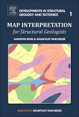
Map Interpretation for Structural Geologists
by Narayan Bose and Soumyajit Mukherjee
Published 14 August 2017
Map Interpretation for Structural Geologists covers various topics, from deciphering topography using contour patterns to interpreting folds, faults, unconformities and dykes. By interpreting several types of maps, this book gives readers the confidence to solve difficult geologic questions related to map interpretation in the classroom and in the field. Interpreting geological and structural maps is an inseparable part of learning structural geology in the undergraduate curriculum and postgraduate development.

Rift and Drift Episodes of Western India since the Mesozoic Era
by Swagato Dasgupta and Soumyajit Mukherjee
Published 1 November 2025
Rift and Drift Episodes of Western India since the Mesozoic Era: Outcrop-Based Analyses, Volume Seven covers the architecture and tectonics of volcanic passive margin of the Indian west coast, as well as on the Deccan Large Igneous Province. Detailed understanding of tectonic evolution and stress regimes of western Indian basins is necessary to this research. As such, this book aims to provide a tectonic framework, structural history and paleostress regimes of the following rift basins of Indian western margin based on outcrop-study: (i) Jaisalmer, (ii) Bikaner- Nagaur, (iii) Barmer, (iv) Cambay and (v) Kutch. The tectonic linkage amongst these basins and with the Indian west coast will also be covered.
The Mesozoic and Tertiary basins of western Indian margin have special importance in terms of their genesis and tectonic evolution. Mesozoic stratigraphy has been identified in Jaisalmer, Kutch and Barmer basins. These basins initiated as intra-cratonic rift basins during Gondwana. Episodic rifting of Africa and India resulting in separation and drifting of the Indian plate during Late Gondwana (Jurassic to Early Cretaceous), developed these basins. Inheritance of pre-existing structures played a key role in basin evolution. The Cambay and the Tertiary rifting of Barmer basin was a consequence of oblique rifting between the Seychelles micro-continent and the Indian plate, having extension direction trending ~NE.
The Mesozoic and Tertiary basins of western Indian margin have special importance in terms of their genesis and tectonic evolution. Mesozoic stratigraphy has been identified in Jaisalmer, Kutch and Barmer basins. These basins initiated as intra-cratonic rift basins during Gondwana. Episodic rifting of Africa and India resulting in separation and drifting of the Indian plate during Late Gondwana (Jurassic to Early Cretaceous), developed these basins. Inheritance of pre-existing structures played a key role in basin evolution. The Cambay and the Tertiary rifting of Barmer basin was a consequence of oblique rifting between the Seychelles micro-continent and the Indian plate, having extension direction trending ~NE.