Sudan Archaeological Research Society Publication
4 total works
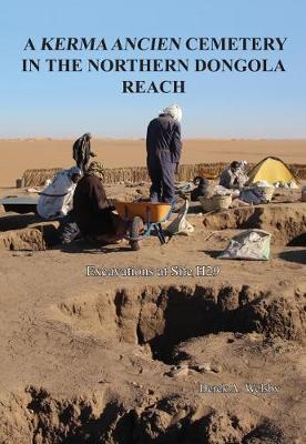
This volume is the final report on the excavations of a Kerma Ancien cemetery discovered by the Sudan Archaeological Research Society during its Northern Dongola Reach Survey conducted between 1993 and 1997. It is one of the very few cemeteries of this date to have been fully excavated and provides interesting data on funerary culture as practised in a rural environment, to be compared with the extensive information available from investigations of the cemetery associated with the metropolis of Kerma 100km to the north. It includes a range of specialist reports on all categories of artefacts recovered as well as on the physical anthropology, archaeobotany and archaeozoology.
Travelling the Korosko Road: Archaeological Exploration in Sudan’s Eastern Desert
by Derek A. Welsby
Published 3 December 2020
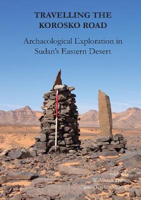
This volume publishes accounts of archaeological exploration carried out during the last 30 years or so in the Sudanese Eastern Desert. It is divided into two related parts.
The first and foremost covers results from the work of the Centro Ricerche sul Deserto Orientale (CeRDO), which is based at Varese in northern Italy. Between 1989 and 2006, CeRDO, directed by the brothers Alfredo and Angelo Castiglioni, ran a pioneering programme of expeditions, which traversed the so-called ‘Korosko Road’ (the main desert route connecting Egypt and Sudan) and followed multiple other tracks throughout the Eastern Desert. They encountered in the process a rich archaeological landscape, hundreds of previously undocumented sites, many frequented over millennia, prominent among them gold-production areas and their associated settlements. The CeRDO record, the photographic database, the material retrieved, to which several of the papers published here are devoted, are now all the more valuable, in that many of these sites have since been badly disturbed and some entirely destroyed by recent goldmining activities.
The second part, introduced by a concise account of the historical usage of the Korosko Road, reports in full on a single, short season of documentation, organized in 2013 under the auspices, and with the support, of the Sudan Archaeological Research Society. Its main aim was detailed recording of a group of pharaonic rock-inscriptions discovered by CeRDO expeditions, most located along the Korosko Road and almost all related to the colonial gold-working industry. The project included also a degree of investigation and mapping of the wider context, as well as the recording and study of associated archaeological material, in particular of ceramic remains. The results complement and usefully extend in part those of CeRDO.
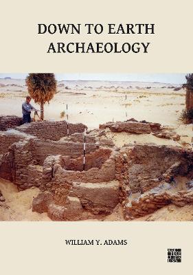
Down to Earth Archaeology collects sixteen archaeological papers by Professor William Y. Adams chosen by the author, who added introductory commentary to each. These articles were written at various times during his lengthy and productive academic career for different purposes and for different audiences. Most of those selected had been previously published only in a limited way, either as conference proceedings or contributions to various Festschriften, and as such he wanted to enable them to reach a wider readership than they had originally. He described this collection as his ‘dernières pensées’.
The essays encompass a wide range of topics, from reflections upon the successes, failures and lessons learned from the UNESCO International Campaign to Save the Monuments of Nubia in the 1960s, in which Bill was very much a leading figure and which he was uniquely positioned to critique, to discussions and criticisms of the theoretical framework of ‘New’ or ‘Processual Archaeology’ and its application of ‘scientific’ methods. Other papers included here are seminal works discussing the ideological concepts of typology and classification and their practical application to archaeological excavations, notably his own major excavations conducted at the large Nubian cityscapes of Meinarti, Kulubnarti and Qasr Ibrim, and the ceramic kilns at Faras.
The essays encompass a wide range of topics, from reflections upon the successes, failures and lessons learned from the UNESCO International Campaign to Save the Monuments of Nubia in the 1960s, in which Bill was very much a leading figure and which he was uniquely positioned to critique, to discussions and criticisms of the theoretical framework of ‘New’ or ‘Processual Archaeology’ and its application of ‘scientific’ methods. Other papers included here are seminal works discussing the ideological concepts of typology and classification and their practical application to archaeological excavations, notably his own major excavations conducted at the large Nubian cityscapes of Meinarti, Kulubnarti and Qasr Ibrim, and the ceramic kilns at Faras.
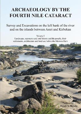
This volume is the first of several devoted to publishing the results of the Sudan Archaeological Research Society’s surveys and excavations in the region of the Fourth Cataract. This, a component of the Merowe Dam Archaeological Salvage Project, was conducted along a 40km stretch of the river on the left bank and on the islands.
Following an introduction to the project, chapters focus on the palaeoenvironment in the concession area between Amri and Kirbekan, on the flora and toponyms, and on the folklore, agricultural practices, architecture and the life styles of the Manasir and Shaqiya inhabitants immediately before the inundation of the region by the Merowe Dam.
Following an introduction to the project, chapters focus on the palaeoenvironment in the concession area between Amri and Kirbekan, on the flora and toponyms, and on the folklore, agricultural practices, architecture and the life styles of the Manasir and Shaqiya inhabitants immediately before the inundation of the region by the Merowe Dam.