Walkabout
2 total works
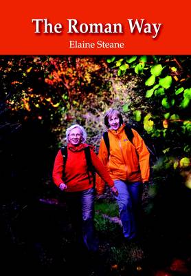
"The Roman Way" is a 174-mile walk, on the theme of Roman roads, using public rights of way. It follows a triangle formed by three Roman roads from Chesterton, near Bicester in Oxfordshire, to Cirencester in Gloucestershire, and on to the Roman walled town of Silchester in Hampshire, returning to the Roman military fort at Alchester near the starting point. The route follows Akeman Street as it crosses the limestone heights of the Cotswold Hills to Cirencester, then south-east following the Ermin Way across the Wiltshire Downs, through the village of Speen in Berkshire, descending to cross the River Kennet as the Romans did. The way continues through the heathlands and pine forest north to Dorchester on Thames. From this Roman settlement, the route goes directly north beside Oxford and across Otmoor, the marsh where the Romans built a bridge to reach the fort at Alchester. The book divides the Roman Way into 17 sections, all of which have suggested access points for shorter distances, information about public transport, a list of tea shops, pubs and accommodation.
Each day's walk is accompanied by the relevant sections of the Ordnance Survey map and is vividly illustrated throughout giving archaeological, historical, botanical and local anecdotal detail.
Each day's walk is accompanied by the relevant sections of the Ordnance Survey map and is vividly illustrated throughout giving archaeological, historical, botanical and local anecdotal detail.
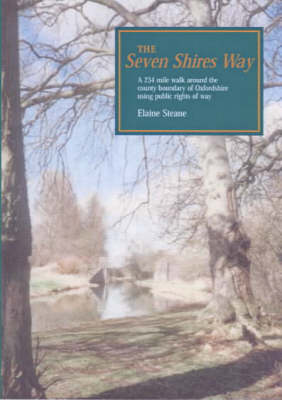
The Seven Shires Way is a 234-mile long walk around the Oxfordshire county boundary. It criss-crosses the boundary taking the walker into seven shires from Gloucestershire to Oxfordshire, Warwickshire, Northamptonshire, Buckinghamshire, Berkshire and Wiltshire. The path passes through a wide variation of scenery: from the marlstone scarp slope of Edgehill in Warwickshire to the ironstone villages of North Oxforshire, the clay vale of Aylesbury, the beech woods of the Chiltern Hills, the riverbank of the Thames, the open downland of Berkshire and Cotswold villages in Gloucestershire. The book divides the walk into 21 sections, all of which have suggested access points for shorter distances, a list of useful accomodation and information about public transport. Each walk is accompanied by the relevant section of the Ordnance Survey map and is illustrated, giving archeological, historical, botanical and literary detail.