Routledge Historical Atlases
11 total works
The complex and often turbulent history of Russia over the course of 2000 years is brought to life in a series of 169 maps. It covers not simply the wars and expansion of Russia but also a wealth of less conspicuous details of its history from famine and anarchism to the growth of naval strength and the strengths of the river systems.
From 800 BC to the fall of the Soviet Union, this indispensable guide to Russian history covers:
* war and conflict: from the triumph of the Goths between 200 and 400 BC to the defeat of Germany at the end of the Second World War and the end of the Cold War.
* politics: from the rise of Moscow in the Middle Ages to revolution, the fall of the monarchy and the collapse of communism.
* industry, economics and transport: from the Trans-Siberian Railway between 1891 and 1917 to the Virgin Lands Campaign and the growth of heavy industry.
* society, trade and culture: from the growth of monasticism to peasant discontent, Labour Camps and the geographical distribution of ethnic Russians.
The Routledge Atlas of the Arab-Israeli Conflict traces not only the tangled and bitter history of the Arab-Jewish struggle from the early twentieth century to the present, including the death of Yasser Arafat and recent proposals for territorial settlement, it also illustrates the move towards finding peace and the efforts to bring the horrors of the fighting to an end through negotiation and proposals for agreed boundaries. In 204 maps, the complete history of the conflict is revealed including:
- the prelude and background to the conflict - from the siting of the Palestinian Jews before the Arab conquest to the attitude of Britain to the Arabs between 1917 and the present
- the Jewish national home - from the Zionist plan for Palestine in 1919 to the state of the Arab world from 1945 to the present day
- the intensification of the conflict - from the Arab response to the UN partition plan of 1947 to the first steps towards the independence of Israel in 1948
- the state of Israel - from the Israeli War of Independence and the Six Day War to the War of Yom Kippur and the first and second Intifada, the suicide-bomb campaign, and the Israel-Hezbollah War of 2006
- the moves to find peace - from the first and second Camp David talks, to the death of Arafat, to the continuing search for peace, including Annapolis, 2007, and beyond.

The graphic history of the Nazi attempt to destroy the Jews of Europe during the Second World War is illustrated in this series of 333 detailed maps.
The maps, and the text and photographs that accompany them, powerfully depict the fate of the Jews between 1933 and 1945, while also setting the chronological story in the wider context of the war itself. The maps include:
- historical background - from the effects of anti-Jewish violence between 1880 and 1933 to the geography of the existing Jewish communities before the advent of the Nazis
- the beginning of the violence - from the destruction of the synagogues in November 1938 to Jewish migrations and deportations, the ghettos, and the establishment of the concentration camps and death camps throughout German-dominated Europe
- the spread of Nazi rule - the fate of the Jews throughout Europe including Germany, Austria, Poland, Greece, Yugoslavia, Bulgaria, Russia, Denmark, Norway, France, Holland, Belgium, Italy, and the Baltic States
- Jewish revolts and resistance - acts of armed resistance, fighting in the forests, individual acts of courage
- Jews in hiding - escape routes, Christians who helped Jews
- the death marches - the advance of the Allies and the liberation of the camps, the survivors, and the final death toll.
This revised edition includes a new section which gives an insight into the layout and organization of some of the most significant places of the Holocaust, including Auschwitz, Treblinka and the Warsaw ghetto, maps that will be especially useful to those visiting the sites.
* the early months of the war: from the fall of Belgium to the fierce fighting at Ypres and Tannenberg
* the developing war in Europe: from Gallipoli to the horrors of the Somme and Verdun
* life at the front: from living underground, the trench system and the mud of Passchendaele to the war graves
* war in the air and at sea: from the Zeppelin raids to the battles in the North Sea, shipping losses and the Atlantic convoys
* technology and the new horrors: from phosgene gas attacks to submarines, tanks and mines
* the home fronts: from German food riots to the air defence of Britain, the Russian Revolution and the collapse of Austria-Hungary
* the Aftermath: from war debts and war deaths to the new map of Europe.

'An unusual and compelling insight into Jewish history... sheer detail and breadth of scale' BBC History Magazine
This newly revised and updated edition of Martin Gilbert’s Atlas of Jewish History spans over four thousand years of history in 154 maps, presenting a vivid picture of a fascinating people and the trials and tribulations which have haunted their story.
The themes covered include:
- Prejudice and Violence- from the destruction of Jewish independence between 722 and 586 BC to the flight from German persecution in the 1930s. Also covers the incidence of anti-semitic attacks in the Americas and Europe.
- Migrations and Movements- from the entry into the promised land to Jewish migration in the twenty- first century, including new maps on recent emigration to Israel from Europe and worldwide.
- Society, Trade and Culture- from Jewish trade routes between 800 and 900 to the situation of world Jewry in the opening years of the twenty- first century.
- Politics, Government and War- from the Court Jews of the fifteenth century to the founding and growth of the modern State of Israel.
This new edition is also updated to include maps showing Jewish museums in the United States and Canada, and Europe, as well as American conservation efforts abroad. Other topics covered in this revised edition include Jewish educational outreach projects in various parts of the world, and Jews living under Muslim rule. Forty years on from its first publication, this book is still an indispensible guide to Jewish history.
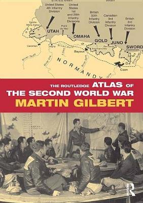
Focusing on the human - and inhuman - aspects of the war, The Routledge Atlas of the Second World War includes examination of:
- Military, naval and air campaigns on all the war fronts
- The war on land, at sea and in the air
- The economic and social aspects of the war
- The global nature of the war, in armed combat and in suffering
- The impact of the war on civilians, both under occupation, and as deportees and refugees
- The aftermath of the war: the post-war political and national boundaries; war graves, and the human cost of the war on every continent.
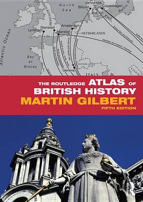
The evolving story of the British Isles forms the central theme of this fascinating and compelling atlas, which covers England, Ireland, Scotland and Wales - and the expansion and gradual disintegration of Britain's overseas empire. This new edition includes:
- Politics - from the Saxon kingdoms and the collapse of England's French Empire to the Tudors and Stuarts, the English Civil War, the Restoration, Parliamentary Reform, the Commonwealth and Europe, the European Union and the Coalition Government formed in 2010
- War and conflict - from Viking attacks and the Norman Invasion to the Armada, two World Wars and the end of empire, the Falklands War, the Gulf War, British forces overseas, terror at home and the wars in Kosovo, Sierra Leone, Afghanistan and Iraq
- Trade and industry - from the post-Norman economy and Tudor trade to industrial unrest and the opening of international trade routes, imports and exports, arms sales and British humanitarian aid overseas
- Religion - from the Saxon Church to the Reformation and the multi-cultural Britain of modern times
- Society and economics - from civilian life in Roman Britain to the Industrial and Agricultural revolutions, the General Strike and the growth of universities, unemployment, homelessness, charitable activities and government expenditure
- Immigration - the growth of immigrant communities, the wide range of countries from which immigrants came, citizenship applications and citizenship granted.
Sir Martin Gilbert is Winston Churchill's official biographer, and one of Britain's leading historians, having written eighty-two books in total. He is an Honorary Fellow of Merton College, Oxford, and a Distinguished Fellow of Hillsdale College, Michigan. He has also most recently served on the committee of the Iraq Inquiry set up by the British Government. For more information, please visit www.martingilbert.com.

The Routledge Atlas of American History presents a series of 163 clear and detailed maps, accompanied by informative captions, facts and figures. The complete history of America is unravelled through vivid representations of all the significant landmarks, including:
- Politics – from the struggle against slavery and the battle for black voting rights to the present day, including the results of the 2008 Presidential election
- Military Events – from the War of Independence to the conflicts in Korea, Vietnam and the Gulf, including additional new maps covering the war in Iraq and the American campaign in Afghanistan.
- Social History – including the fate of the American Indians, the growth of female emancipation, and recent population movements and immigration
- Transport – from nineteenth-century railroads and canals to the growth of air travel and recent ventures into space
- Economics – from early farming and industry to urbanisation and the ecological struggles of the present day
This revised edition is fully updated to cover the 2008 presidential election, and also addresses President Obama’s healthcare policy and first overseas travels. New maps have been drawn which detail the problem of pollution, as well as the most recent developments in US relations with Iran, Iraq and Afghanistan.

This unique Atlas traces the history of Jerusalem from biblical times to the present day. Each map is illustrated by a facing page of prints or photographs, to give a complete pictorial and cartographic overview of this fascinating city of the Middle East. Coverage begins in ancient times, showing the impact of the Jews, Christians, Muslims, Romans and Crusaders on the development of this holy city. Special emphasis is placed on the last 150 years, during which Jerusalem grew from a remote and impoverished town of the Ottoman Empire to a flourishing capital city. Up-to-date maps and figures show the recent expansion of suburbs and settlements, the Wall and new urban and political developments. An extensive bibliography provides a rich source of information on further reading.