Archaeological Monographs of the British School at Rome
3 primary works
Book 15
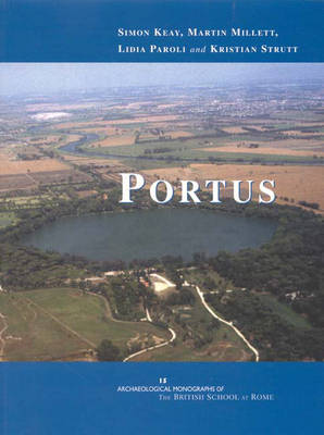
In AD 42, the Emperor Claudius initiated work on the construction of a new artificial harbour a short distance to the north of the mouth of the Tiber. The harbour facilities were enlarged at the instigation of the Emperor Trajan at the beginning of the second century AD, and Portus remained the principal port for the City of Rome into the Byzantine period. The surviving archaeological remains and comments by ancient sources make it clear that Portus lay at the heart of Rome's maritime façade. As well as being a key Mediterranean centre for passengers and for the loading, unloading, transshipment and storage of products from across the Empire, it was also designed to make an ideological statement about the supremacy of Rome in the world. Portus is, thus, of key importance to understanding Rome and her relationship to the Empire. The project that forms the subject of this book was designed to use non-destructive techniques of topographic and geophysical survey in combination with systematic surface collection to provide a new understanding of the plan of Portus. The work was undertaken between 1997 and 2002 as a collaboration between the Soprintendenza per i Beni Archeologici di Ostia, the British School at Rome, and the Universities of Southampton, Durham and Cambridge. This volume presents the full results of the survey and uses them as the basis for a re-evaluation of the whole port complex. The geophysical survey results are interpreted in the context of earlier work at the site in order to offer new perspectives on the character and development of the site.
Book 18
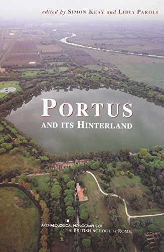
Portus was the principal maritime port of Rome between the first and sixth centuries AD, and is one of the largest, richest and most accessible Roman ports in the Mediterranean. However, whilst it has been documented archaeologically since at least the Renaissance, its key role in the movement of traded goods between Rome and the Mediterranean consistently has been underplayed in favour of the fluvial port of Ostia. This volume, arising from a workshop held at the British School at Rome, seeks to begin to redress this imbalance, to share the results of the various projects currently focused on Portus and its Hinterland, and to foster greater public awareness of this remarkable site. xvi, 320p, 151 b/w illustrations and 16 colour plates
Book 22
Ocriculum (Otricoli, Umbria)
by Sophie Hay, Simon Keay, and Martin Millett
Published 30 September 2013
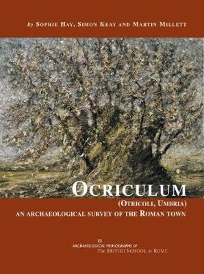
The remarkable extent, state of preservation and monuments of Ocriculum make this one of the most important archaeological sites in ancient Italy. Located close to the river Tiber, north of Rome on the Via Flaminia, many travellers were drawn to Otricoli and its landscape, lured by its beauty. Significant monumental remains of the Roman town are still visible: the amphitheatre, the theatre, the forum area, basilica, baths and nymphaeum. Academic studies devoted to this important town are many, and this volume represents a further contribution to our understanding of the ancient town. Here are published the results of the urban survey in 2002–5. Field survey was coupled with a geophysical survey that has identified new features. This work adds greatly to our understanding of the ancient town and tells a different story to that usually told of Roman towns in terms of scale, layout and organization, as well as architectural and sculptural finds; and thus contributes significantly to debate on Roman urbanism.
With contributions by Luana Cenciaioli, Sophy Downes, Rose Ferraby, Enrico Floridi, Shawn Graham, Salvatore Piro, Tim Sly, Lacey M. Wallace, Andrew Wallace-Hadrill and Sabrina Zampini
With contributions by Luana Cenciaioli, Sophy Downes, Rose Ferraby, Enrico Floridi, Shawn Graham, Salvatore Piro, Tim Sly, Lacey M. Wallace, Andrew Wallace-Hadrill and Sabrina Zampini