Walk! Tenerife

by David Brawn and Ros Brawn

Published 16 October 2006
A new edition of Walk! Tenerife is due to be published in September 2017 with completely revised and new walking routes. Comprehensive walking guide book to Tenerife's best walking. 46 fully detailed walking routes with 1:25,000 scale maps and GPS Waypoints. A real 'Rolls Royce' of a walking guide to the authors' home island. Contents:- The Authors. Introduction. Map Information. Walk Locator Maps. Map Notes & Legend. Walking Information: Using GPS on Tenerife.Symbols Rating Guide. THE WALKS. WALKS IN THE NORTH 1 Flora Loop - 3 walker, 1 hour, 3.8 kilometres, ascents & descents 180 metres, 3 refreshments (circular) 2 Downhill to La Florida - 2 walker, 11/2 hours, 5.5 kilometres, ascents 50 metres, descents 620 metres, 2 refreshments (linear) 3 Choza Classic - 4 walker, 2-21/2 hours, 9 kilometres, ascents & descents 320 metres, 2 refreshments (circular) 4 Chimoche Loop - 3 walker, 2 hours, 6 kilometres, ascents & descents 240 metres, 2 refreshments (circular) 5 Mighty Mountain Path - Los Organos - 5 walker, 41/2 hours, 13 kilometres, ascents & descents 650 metres, vertigo risk, 2 refreshments (circular) 6 King of the North - 4 walker, 51/2-6 hours, 21 kilometres, ascents 400 metres, descents 1000 metres, 1 refreshments (linear) WALKS IN THE SOUTH Geranium Walk 7 Life in the Raw - 3 walker, 2 hours, 7 kilometres, ascents & descents 150 metres, 2 refreshments (figure of eight) 8 Barren Grandeur - 3 walker, 3A hours, 14.
7 kilometres, ascents & descents 200 metres, 4 refreshments (linear) Alternative Finish - Faro de Rasca to Los Cristianos 9 Mount Guaza - 4 walker, 21/2 hours, 9 kilometres, ascents & descents 430 metres, 0 refreshments (pan-handle circular) 10 Coastal Escapism - 3 walker, 3...hours, 14 kilometres, ascents & descents100 metres, 4 refreshments (linear) 11 Picos Las Americas - 3 walker, 1 hour, 3 kilometres (one way), ascents & descents 350 metres, 0 refreshments (linear) 12 Down to Town - 3 walker, 21/2 hours, 8.5 kilometres, ascents 130 metres, descents 650 metres, 0 refreshments (linear) 13 Adeje Skywalker & The White House - 4 walker, 3-3A hours, 12 kilometres, ascents 300 metres, descents 400 metres, vertigo risk, 0 refreshments (linear) Alternative (Drivers): Torviscas Alto The White House - 2/3 walker, 70 mins, 4.5 kilometres, ascents & descents 100 metres, 0 refreshments (linear) 14 Taucho Tour (La Quinta) - 3 walker, 11/2-2 hours, 6 kilometres, ascents & descents 300 metres, 0 refreshments (circular) 15 Wow!Spectacular to Adeje - 4 walker, 4 hours, 12 kilometres, ascents 150 metres, descents 1000 metres, vertigo risk, 0 refreshments (linear) 16 Queen of the South - 4 walker, 41/2 hours, 14 kilometres, ascents 250 metres, descents 900 metres, 2 refreshments (linear) 17 Walkers Who Lunch - new route 2012 - 2 walker, 31/2 hours, 15 kilometres, ascents 70 metres, descents 960 metres, 4 refreshments (linear) 18 Fantasia - 4 walker, 3 hours, 9 kilometres, ascents & descents 550 metres, 4 refreshments (circular, with linear option) 19 Table Mountain - 4 walker, 31/2 hours, 11 kilometres, ascents & descents 450 metres, 0 refreshments (linear) 20 GR131 Vilaflor - Ifonche - Arona - 4 walker, 51/2 hours, 18 kilometres, ascents 450 metres, descents 1200 metres, vertigo risk, 5 refreshments (linear) WALKS IN THE WEST 21 Wild West Tour - 3 walker, 2 hours, 7 kilometres, ascents 130 metres, descents 470 metres, 2 refreshments (linear) 22 An OK Corral - 3 walker, 1A hours, 5 kilometres, ascents & descents 170 metres, 0 refreshments (linear) 23 True Grit - updated version 2012 - 4 walker, 2A hours, 9 kilometres, ascents & descents 430 metres, 3 refreshments (circular) 24 Lasso La Hoya - new route 2012 - 3 walker, 1.
5 hours, 5 kilometres, ascents & descents 450 metres, 2 refreshments (circular) 25 Laurel & Hardy - 3 walker, 2 hours, 6.5 kilometres, ascents & descents 300 metres, 4 refreshments (circular) 26 Saddle Up and Round That Mountain - 4 walker, 3 hours, 9 kilometres, ascents & descents 450 metres, vertigo risk, 0 refreshments (circular) 27 Picnic at Hanging Rock & Guegue - 4 walker, 21/2 hours, 10 kilometres, ascents & descents 400 metres, vertigo risk, 0 refreshments (linear) 28 Survival of the Fittest - 6 walker, 6 hours, 17 kilometres, ascents& descents 600 metres, vertigo risk, 4 refreshments (linear) 29 The Scenic Route to Masca - 3 walker, 3 hours, 9 kilometres, ascents 300 metres, descents 850 metres, slight vertigo risk, 3 refreshments (linear) CENTRAL HIGH ALTITUDE WALKS 30 Toffee Mountain - 3/4 walker, 3 hours, 13.5 kilometres, ascents & descents 200 metres, 1 refreshments (circular) 31 Arenas Negras: Black Sand Surprise - 3 walker, 21/2 hours, 9 kilometres, ascents & descents 300 metres, 0 refreshments (circular) 32 La Fortaleza - 4 walker, 4 hours, 15 kilometres, ascents & descents 250 metres, 1 refreshments (linear) 33 Roques de Garcia - 3 walker, 1...hours, 4 kilometres, ascents & descents 140 metres, 1 refreshments (circular) 34 Paisaje Lunar: a Tenerife Classic - 3-5 walker, 2 hours, 7 kilometres, ascents & descents 320 metres, 0 refreshments (circular) 35 Lunar Orbit 2 - 3 walker, 21/2 hours, 9.
5 kilometres, ascents & descents 370 metres, 0 refreshments (circular) 36 Mighty Guajara - 5 walker, 41/2 hours, 10 kilometres, ascents & descents 720 metres, 1 refreshments (linear/circular) 37 Siete Canadas - 3/4 walker, 4 hours, 16.4 kilometres, ascents & descents 200 metres, 1 refreshments (linear) 38 The Big One - Crater Rim Challenge - 5 walker, 61/2 hours, 18 kilometres, ascents 300 metres, descents 900 metres, vertigo risk, 2 refreshments (linear) 39 Parador - Degollada de Guajara - Paisaje Lunar - Vilaflor - 5 walker, 6 hours, 18 kilometres, ascents 300 metres, descents 1000 metres, 2 refreshments (linear) 40 On Top of the World - Mount Teide - 4/5 walker, 4 hours, 10 kilometres, ascents 180 metres, descents 1200 metres, 0 refreshments (linear) ANAGA MOUNTAIN WALKS 41 Las Mercedes - Llano de los Loros - 3 walker, 11/2 hours, 5 kilometres, ascents & descents 150 metres, 2 refreshments (pan-handle circular) 42 Cruz del Carmen Circular - 4 walker, 4 hours, 10.8 kilometres, ascents & descents 460 metres, 2 refreshments (pan-handle circular) 43 Casa Carlos - Taborno - 4 walker, 21/2 hours, 6 kilometres, ascents & descents 390 metres, 1 refreshments (linear) 44 Las Carboneras - Taborno - 3 walker, 1.
..hours, 3 kilometres, ascents & descents 170 metres, 0 refreshments (linear) 45 Ensillada Recreation Area - Chamorga - 4 walker, 3 hours, 7 kilometres, ascents 100 metres, descents 450 metres, 1 refreshments (linear) 46 Chamorga Circular - 4/5 walker, 4+ hours, 9 kilometres, ascents & descents 780 metres, 1 refreshments (circular) Glossary. Appendix B: Other Walking: Montana Blanca & Barranco del Infierno Place Names Index

Walk Lanzarote

by Jan Kostura, David Brawn, and Ros Brawn

Published 8 June 2004
Lanzarote's most popular walking guide book just got even better. Walk! Lanzarote 4th edition builds on the reputation of our earlier editions with more walks and comprehensive updating so that it caters for the needs of the increasing number of people who would like to combine some walking with a holiday on the Fire island. Walk Lanzarote explodes the myth that there is nowhere worth walking on the island as we range through strolling on coastal promenades, walking across alpine style meadows, striding over the lava sea, dropping into volcanoes, sitting on high mountain seats - quite simply you will be amazed at the wide variety of stunning landscapes the Fire island has to offer the adventurous leisure walker. New for the 4th edition; new extended coastal route from Arrieta to Los Cocoteros to Costa Teguise, new Playa Blanca to Las Brenas to Yaiza on the GR131, which also updates our Yaiza to Las Brenas circular, newly revised Tabayesco circular, Montana Blanca and Montana Soo are circular adventures in new locations, revised Helechos Cirrcular now starting at Guinate, Yaiza - Uga Circular including a section of the GR131, El Golfo Circular in detail and available as a Timanfaya guided walk, Mirador del Rio, and the revised Corona's Northern Tour. Walk Lanzarote's forty one main walking routes provide a wide variety of adventures with routes ranging from family friendly costal promenades through a surprising range of landscapes up to some serious hiking. Every route is an adventure that will make you eager to explore further on this spectacular island. Walk Lanzarote is produced to our highest standards with walk summary and rating, fully detailed description, frequent timings so you can check your progress, compass directions, and gps waypoints for all country routes. Each country route has full 1:40,000 scale colour mapping and gps waypoints dedicated to that route, while our Teguise town walk uses a large scale street plan. All routes are illustrated with colour photos. Culture and agriculture are included along with a Thingy section on modern art. We've emphasised the Access by Bus sections for each walk along with our Access by Car information for each walking route. Map sections for each route are taken from the Lanzarote Tour & Trail Super-Durable Map 5th edition. For gps users the gps waypoint files are available as a free downloadable zip file on the Discovery Walking Guides website. Quite simply the best book of Lanzarote that you can buy. If this is your first visit to Lanzarote then Walk! Lanzarote plus Lanzarote Tour & Trail Map will give you a series of adventures that will have you returning to the Fire island to experience more.

Walk! La Gomera

by Charles Davis, David Brawn, and Ros Brawn

Published 1 August 2000
La Gomera is somewhere special. Breathtaking landscapes, idyllic Canary Islands climate, ancient laurel forest, massive gorges, high ridges, outstanding flora, unspoilt villages; this is perhaps as close to a hikers paradise as it is possible to get. Such a special island deserves only the best; "Walk! La Gomera" - 34 main walking routes plus short walk and stroll options. Each route has: summary including ratings for Effort, Time, Distance, Ascents/Descents, Refreshments and Vertigo risk; fully detailed walk description including frequent timings to check your progress; full colour 1:40,000 scale map of the route; GPS Waypoints for every key point on the route; plus colour island map and regional Walk Locator maps. There are some easy routes. There are some awesome routes. Some routes have vertiginous sections. With Charles Davis's excellent descriptions you will know which routes are for you, and all of them are a true adventure in paradise. Walk La Gomera's Walking Routes:- 1 Degollada de Peraza - San Sebastian, 2.5 hrs, 9 kms, ascents negligible, descents 1000 mts (linear). 2 Roque Sombrero & Playa de la Guancha, 4.7 hrs, 16 kms, asc 300 mts, desc 1300 mts (lin).
3 Los Roques, 3 hrs, 10.5 kms, asc & desc 700 mts (circular). 4 Pista Forestal de Majona & Playa de la Caleta, 5.5 hrs, 23 kms, asc 500 mts, desc 950 mts, vertigo risk (lin). 5 Barranco & Lomo de Azadoe, 1.5 hrs, 4 kms, asc & desc 250 mts (circ). 6 Jerdune - Jardin Tecina, 3.5 hrs, 14 kms, asc 250 mts, desc 1150 mts (lin). 7 Las Toscas - Degollada de Peraza, 2.8 hrs, 10 kms, asc 600 mts, desc 300 mts (lin). 8 Playa Santiago - Targa, 4.3 hrs, 17 kms, asc & desc 750 mts (circ). 9 Barranco de Benchijigua, 4 hrs, 12 kms, asc & desc 600 mts (circ). 10 Barranco de Guarimiar, 4.1 hrs, 13 kms, asc & desc 850 mts, vertigo risk (circ). 11 Imada - Garajonay, 3 hrs, 12.5 kms, asc & desc 500 mts (circ). 12 Arure - Las Hayas, 3.3 hrs, 13 kms, asc & desc 300 mts (circ). 13 Las Creces Roundabout Route, 2.4 hrs, 10 kms, asc & desc 300 mts (circ). 14 Cercado - Valle Gran Rey, 2.2 hrs, 10 kms, asc & desc 300 mts (circ). 15 La Merica, 2.2 hrs, 10 kms, asc 100 mts, desc 800 mts (lin). 16 Valle Gran Rey - Hayas, 3 hrs, 8 kms, asc & desc 650 mts, vertigo risk (circ). 17 Chipude - Garajonay, 3.4 hrs, 14.5 kms, asc & desc 500 mts (circ). 18 Fortaleza, 1.7 hrs, 4.7 kms, asc & desc 250 mts (circ).
19 Barranco de Erque, 5.5 hrs, 13 kms, asc & desc 750 mts, vertigo risk (circ). 20 Ermita de Nuestra Senora de Guadalupe, 3 hrs, 10 kms, asc & desc 350 mts (circ). 21 Tequergenche, 3.3 hrs, 12 kms, asc & desc 350 mts (lin). 22 Barranco de Argaga, 5 hrs, 11 kms, asc & desc 850 mts (circ). 23 Barranco de Arure, 1.5 hrs, 4.5 kms, asc & desc 200 mts (lin). 24 Lomo del Carreton, 3 hrs, 4.5 kms, asc & desc 600 mts, vertigo risk (circ). 25 Barranco de Guaranet, 3+ hrs, 10 kms, asc & desc 500 mts (circ). 26 Las Mimbreras, 1.4 hrs, 4.5 kms, asc & desc 200 mts (circ). 27 Hayas - Vallehermoso, 2.8 hrs, 9.5 kms, asc 250 mts, desc 900 mts (lin). 28 Roque Cano, 3 hrs, 10.5 kms, asc & desc 600 mts (circ). 29 Ermita de Santa Clara + Chorros de Epina, 4 hrs, 14 kms, asc & desc 650 mts (circ). 30 Las Rosas - Hermigua, 2.3hrs, 8.5 kms, asc 200 mts, desc 600 mts (lin). 31 Pared de Agulo, 3 hrs, 10 kms, asc & desc 600 mts, vertigo risk (circ). 32. The Head of the Table & The Fat Back, 5 hrs, 14 kms, asc & desc 750 mts, vertigo risk (circ). 33 El Cedro Tunnel, 1 hr, 4.5 kms, asc & desc 250 mtrs (circ). 34 Classic Garajonay, 3.5 hrs, 10 kms, asc 150 mtrs, desc 1000 mtrs, vertigo risk (lin).
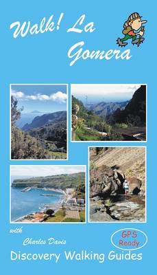
Walk La Gomera's walking routes are also available as Viewranger routes to use on your 3G phone or tablet. GPS waypoint files (in gpx format) are available for free download at Discovery Walking Guides website.

Walk! La Palma

by Charles Davis

Published 24 March 2005
New revised and updated edition of Walk! La Palma including latest Tour & Trail Mapping plus Altitude Profiles. Walk! La Palma includes 34 fully detailed walking route itineraries. Each walking route itinerary includes:- - walking route summary - ratings for Effort, Time, Distance, Ascents/Descents, Refreshments and Vertigo risk - fully detailed walk description, including frequent timings to aid navigation and check your progress - GPS Waypoints at every key point on every route where there is good gps reception - full colour 1:40,000 scale map of the route - short walk and stroll alternatives There are some easy routes. There are some challenging routes for fit experts. With Charles Davis' excellent walk descriptions you'll know which routes are for you - and all of them are a true adventure. The steepest island in the world, the deepest crater, the clearest skies: volcanoes you can climb without being shot into orbit; a subtropical forest minus the slimy things slinking up your trouser leg; black beaches, blue seas, high mountains, vegetation that is literally flamboyant, everything linked by 1080 kilometres of waymarked paths; and all virtually untouched by tourism.
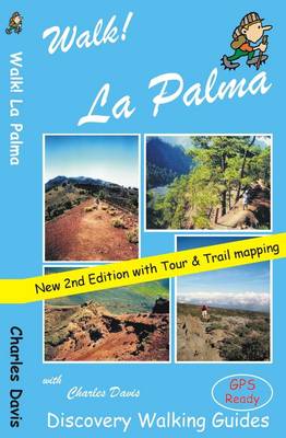
If this sounds divine or like some lost paradise, you're not the first to think so, previous commentators have identified La Palma as the prototype for both the Elysian Fields and Atlantis! The fanciful stuff aside, the island is a walker's idyll, utterly tranquil, verdant and almost unspoiled. GPS Waypoint files (in gpx file format) for Walk! La Palma are available as a free zip file download on Discovery Walking Guides website. Synopsis 34 detailed walking route itineraries. Each of it includes:- walking route summary; ratings for Effort, Time, Distance, Ascents/Descents, Refreshments and Vertigo risk; and more. It also provides background information along with details of accommodation, buses, official walking routes, mountain biking, museums, and information offices. Walk! La Palma walking routes are also available as Viewranger routes for use on your 3G phone or tablet.

Walk! Mallorca West

by Charles Davis

Published 4 January 2005
Revised edition of Walk! Mallorca West incorporating updated and new routes from the GR221 Dry Stone Way ready for adventuring on foot in the western landscapes of Europe's most popular holiday walking destination. Now includes the opening sections of the GR221 'Ruta de Pedra en Sec' (Dry Stone Way) covering the route as far as Esporles plus the new alternative starting routes from Capdella and Puigpunyent as day walks combining with the original Mallorca West routes to provide a network of walking adventures to suit a wide range of walkers from leisure walkers up through the exertion scale to rugged mountain adventurers. Map sections from Mallorca North & Mountains Tour & Trail Map plus gps waypoints for pin-point navigational accuracy on every walking route. Note that this book is matched with the Mallorca North & Mountains Tour & Trail Map (paper & Super-Durable editions).

Walk! Menorca

by David Brawn and Ros Brawn

Published 4 January 2005
The island of Menorca (Minorca) is a true Mediterranean gem; unspoilt countyside, beautiful beaches, prehistoric sites by the bagfull, a wealth of wild flowers, wild tortoises, butterflies, bird life, historic towns and relics from the island's turbulent past. Such a special island deserves only the best so Walk! Menorca has been researched to our highest 'no compromise' research standards so that you can embark on the adventures in "Walk! Menorca" confident that the routes have been properly researched. 40 fully detailed walk itineraries range from town walks around Ciutadella and Mao (Mahon) to adventurous coastal routes such as Walk 18 Cala Mesquida - Es Grau. Every walking route has; Walking Route Summary; Ratings for Effort, Time, Distance, Ascents/Descents and Refreshments; Fully detailed walk description with frequent timings to aid navigation; Full colour 1:40,000 scale map of the route; and GPS waypoints for key points on all country routes. All 40 walking routes in "Walk! Menorca" have 'uncontested' access at the date of publication, and should remain open if walkers respect the countryside they walk through.
Some of Menorca's riches can be reached by car, but to truely get the best from the island you should set out on foot to discover these beautiful landscapes and beauty spots.

Walk! The Axarquia

by Charles Davis

Published 20 September 2010
Walk the Axarquia guide book reformated to A4 page format of 88 pages as a digital pdf file available to download from www.dwgwalking.co.uk website. If you are looking for something wild, but close to resort civilisation, then "Walk! the Axarquia" could be for you. The Axarquia contains the Sierras Tejeda and Almijara which form the backbone of the region. Blessed with high summits, dizzying pinnacles, dramatic crags, deep ravines, dozens of springs, delightful rivers and the best coves on the Costa del Sol, this is a region with something for everyone. The only prerequisites for benefiting from all this are a desire to get off the beaten track and a set of relatively sturdy legs. Charles Davis has brought together 32 fully detailed walking routes for his Axarquia 'home region' ranging from moderate routes up to adventures requiring a good degree of fitness. Whichever group you find yourself in you'll find plenty of adventures to tempt you away from the 'Costa del Concrete'! All walking routes include:- - walking route summary. - ratings for Effort, Time, Distance, Ascents/Descents, Refreshments and Vertigo Risk.
- fully detailed walk description including frequent timings to aid navigation and check your progress. - gps waypoints at every key point on every route. - full colour Tour & Trail Map section for the route. - short walk and stroll alternatives. New for our second edition are:- - Tour & Trail Map sections replacing the old IGN mapping, giving easy to read clarity along with larger map sections. - Altitude Profiles so you can see at a glance the ascents and descents involved in the walking route. - revised access details guiding you to the start of each walking route, including parking advice and waypoints for any off tarmac driving. - details of additional walking routes in the Axarquia region. - more pictures helping you identify starting points for routes. With all the extra detail, larger mapping, pictures et al our second edition has expanded to 176 full colour pages (88 A4 pages in the pdf digital edition) to give you the best, and best value, walking guide book to this exciting region.

Walk! Madeira

by David Brawn and Ros Brawn

Published 10 July 2006
"Walk Madeira" is a fully updated replacement for "35 Madeira Walks" by the same authors. Fully detailed walk descriptions include route summary, 40K colour map, frequent timings and GPS waypoints for pin-point navigational accuracy. Routes cater for a wide range of walking abilities and Vertigo ratings are given for relevant routes.

If the words 'Costa del Sol' conjure up images of long, featureless beaches occupied by regimented rows of sun loungers while across the road are the Costa del Concrete apartment blocks, then we have an escape for you. Previously, you would have had a two hour drive to the Alpujarras for our nearest walking destination. Now a short drive inland and you can be in the Axarquia region, one of Spain's wild places preserved from the clutches of property developers. It's a region of historic white villages and towns scattered amongst dramatic hills and mountains, and blessed with a kind climate in which grape vines, mango trees and kiwi fruits thrive alongside ancient olive and almond groves. Previously little known even to local residents, and actually unknown to us until Charles suggested the region, there has been very little published in English for the region of Axarquia - until now. Charles' and Jeanette's prodigious capacity for walking research has produced a whole range of routes covering the best walking in the region, including routes in the Parque Natural nature reserves of Sierra de Almijara and Sierra de Tejeda.
Walking itineraries have been chosen with hire cars in mind as there is little public transport. Charles Davis' skilful writing provides the essential background along with inspirational fully detailed walk descriptions that will take you back to a time when the world was young - only minutes from that Costa del Concrete by car but aeons away in the mind. Not so high energy as Andorra, but a bit more so than Sierra de Aracena; if you are looking for something wild and new, but close to resort civilisation, then "Walk! Axarquia" could be for you; the most difficult part is saying it and spelling it!