Canoe and Kayak
3 total works

Canoeing and Kayaking Florida
by Johnny Molloy, Elizabeth Carter, and John Pearce
Published 1 December 2007
Completely updated, Canoeing & Kayaking Florida, 2nd Edition, is the most comprehensive guide to the best of Florida's unique streams, springs, creeks, and rivers. Engaging and concise, this all-encompassing guide spares readers encyclopedic fluff in favor of practical information, and includes expanded regional maps and revised river maps.

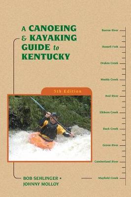
Explore Hidden Kentucky in Your Kayak or Canoe
Wet your paddle-and whet your paddling appetite-with the authoritative guide to the waterways of Kentucky. From the eastern coalfields to the Mighty Mississippi along the western border, this is your updated resource for paddling the creeks, rivers, and waterways of the Bluegrass State. Canoeing & Kayaking Kentucky covers thousands of miles of paddling, including almost all of the state's paddleable waterways, in 77 river profiles that range in difficulty from scenic floats down the Green to whitewater runs on the Russell Fork.
Authors Bob Sehlinger and Johnny Molloy combine the latest technology with good old-fashioned paddling trips to make your paddling adventures even easier to execute with completely revised and improved maps, access points, river gauges, and mileages, as well as updated contact information and GPS coordinates for every put-in and takeout. Between them, Bob and Johnny have paddled thousands of miles. This combined experience makes Canoeing & Kayaking Kentucky useful for paddlers of all types. Paddling has never been better in Kentucky!
With approximately 54,000 miles of streams and rivers, Kentucky has more miles of running water than any state except Alaska. Wet your paddling blade and whet your paddling appetite with the authority on paddling the waterways of Kentucky--A Canoeing & Kayaking Guide to Kentucky. Researched and written by veteran outdoor writers and paddlers Bob Sehlinger and Johnny Molloy, A Canoeing & Kayaking Guide to Kentucky is as vital to enjoying Kentucky's waterways as the boat itself. From the coal fields of Eastern Kentucky to Kentucky's western border along the Mighty Mississippi, this redesigned and completely updated guide to paddling the creeks, rivers, and coastal waterways of the Bluegrass State covers thousands of miles of paddling that range in difficulty from scenic floats down the Cumberland to whitewater runs of the Russell Fork. New maps, new river profiles, completely updated contact information, at-a-glance data that includes class, length, time, gauge, level, gradient, volume, and ratings for solitude and scenery make this guide an indispensable river companion.