Battleground Europe
5 total works
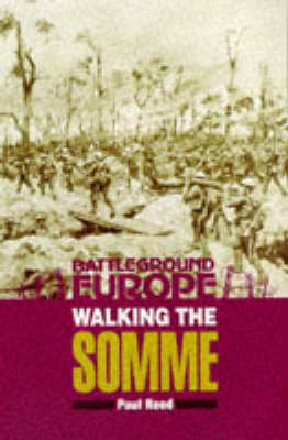
This book serves as a companion to the whole Somme range of battleground guides, The Somme is an ideal area for an educational walk and little has changed since the rebuilding work which took place after the war. The walks begin at Gommecourt and take in sections of the line through Serre, Beaumont Hamel, Thiepval down to Montauban, all areas that saw fighting throughout the five months of the Battle of the Somme.

Walking Arras marks the final volume in a trilogy of walking books about the British sector of the Western Front. Paul Reed once more takes us over paths trodden by men who were asked to make a huge ' and, for all too many, the ultimate ' sacrifice. The Battle of Arras falls between the Somme and Third Ypres; it marked the first British attempt to storm the Hindenburg Line defences, and the first use of lessons learned from the events of 1916. But it remains a forgotten part of the Western Front. It also remains one of the great killing battles of the Great War, with such a high fatal casualty rate that a soldier's chances of surviving Arras were much slimmer than even the Somme or Passchendaele. Most soldiers who served in the Great War served at Arras at some point; it was a name very much in the consciousness of the survivors of the Great War. Ninety years later, while there has been development at Arras, it is still an impressive battlefield and one worthy of the attention of any Great War enthusiast. This book will give a lead in seeing the ground connected with the fighting in 1917.
Making a slight departure from the style of the previous two walking books, the chapters look at the historical background of an area and then separately describe a walk; with supplementary notes about the associated cemeteries in that region.
Making a slight departure from the style of the previous two walking books, the chapters look at the historical background of an area and then separately describe a walk; with supplementary notes about the associated cemeteries in that region.
Paul Reed's latest battlefield walking guide covers the site of the largest amphibious invasion of all time, the first step in the Allied liberation of France and the rest of northwest Europe. The places associated with the landings on the Normandy coast on 6 June 1944 are among the most memorable that a battlefield visitor can explore. They give a fascinating insight into the scale and complexity of the Allied undertaking and the extent of the German defences - and into the critical episodes in the fighting that determined whether the Allies would gain a foothold or be thrown back into the sea. All the most important sites are featured, from Pegasus Bridge, Merville Battery, Ouistrehem and Longues Battery to Juno, Gold, Omaha and Utah Beaches, Pointe du Hoc and Sainte-Mere-Eglise. There are twelve walks, and each one is prefaced by a historical section describing in vivid detail what happened in each location and what remains to be seen. Information on the many battlefield monuments and the military cemeteries is included, and there are over 120 illustrations.
Walking D-Day introduces the visitor not only to the places where the Allies landed and first clashed with the Germans defenders but to the Normandy landscape over which the critical battles that decided the course of the war were fought.
Walking D-Day introduces the visitor not only to the places where the Allies landed and first clashed with the Germans defenders but to the Normandy landscape over which the critical battles that decided the course of the war were fought.