Great Britain & Ireland Atlas 2016

by Michelin

Published 1 September 2015
Full of practical features, the Michelin Road Atlas Great Britain & Ireland 2016 is the perfect companion for your everyday journey and holiday planning. Updated every year, it gives you clear and accurate information for a safe and enjoyable journey thanks to a detailed mapping scale of 1/300 000. Smart and practical, this atlas includes a route planner, a time and distance chart to help you optimise your journey as well as 52 city plans with QTR codes for easy access to your smartphone for online mapping and tourist information! Michelin's safety alerts warn you about dangerous driving areas, such as steep hills, level crossing as well as risk zone subject to tighter speed check.The Michelin Great Britain and Ireland road atlas 2016 also shows tourist sights, leisure facilities, as well as scenic routes so that you can make the most of your journey.

(Updated 2019) Michelin Road Atlas Benelux and North of France is the perfect companion for an enjoyable and safe drive. Convenient and easy to use thanks to its spiral bound cover.

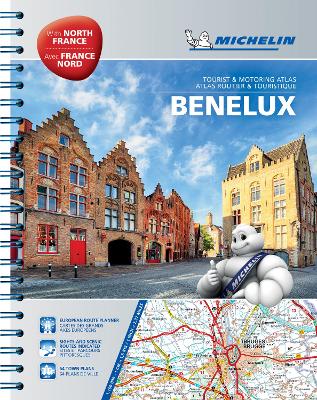
Michelin Road Atlas Benelux and North of France will provide you with precise and reliable information with its mapping scaled 1/150 000 for an enjoyable journey in Northern France, Belgium, Luxembourg and Netherlands. The route planner as well as the time and distance charts will help you plan and optimise your journey, whilst new location maps on top of each page as well as highly practical street maps will ensure an easy navigation within the atlas. Tourist sights, leisure facilities and scenic routes will add pleasure to your journey.

In addition to clear and accurate mapping, the Michelin motoring atlas Benelux and North of France will help you optimise and add comfort to your journey:

* Detailed mapping with a scale 1/150 000
* Mileage chart and journey times to help you plan your journey
* European route planner
* Key to Map Pages to quickly access your region of interest
* 68 town plans for easy navigation in urban areas
* An extensive place name index to easily identify the destination of your choice
* Comprehensive and detailed key to symbols used
* Tourist information with place of interest and leisure facilities, as well as scenic routes
* Michelin Safety Alerts (Steep gradients, dangerous routes, zones subject to tighter speed controls ...)
* Location maps on top of each pages for an easy navigation within the atlas
* Highly practical street maps embedded in the map of their surrounding areas


Coverage:
Netherlands
Belgium
Luxembourg
North France (Calais to Gisors to Thionville)

USA, Canada, Mexico Atlas 2016

by Michelin

Published 11 October 2015
Whether it's an epic adventure, a short road trip, or a quick jaunt, Michelin's freshly updated, spiral-bound North America Road Atlas 2016 with its clear, accurate mapping helps travellers find their way. This tiled atlas easily complements online navigation, while its big picture and road details aid in advance planning and en route decisions. Included is a section on events and festivals to add local colour to a trip, plus GPS coordinates to 2000+ parks for outdoor fun. Rely with confidence on Michelin's deluxe atlas.

Germany/Austria Atlas 2017

by Michelin

Published 9 January 2017
Michelin motoring atlases are the perfect companion for an enjoyable and safe drive. Convenient and easy to use thanks to their spiral bound cover, Michelin motoring atlases cover a variety of countries and will provide you with precise and reliable information with newly annually updated maps. The route planner as well as the time and distance charts will help you plan and optimise your journey. Tourist sights, leisure facilities and scenic routes will add pleasure to your journey.

Michelin Map Europe 2013

by Michelin

Published 11 January 2013
Michelin motoring atlas Europe 2013 is the perfect companion for an enjoyable and safe drive in Europe. Convenient and easy to use thanks to its spiral bound cover, Michelin motoring atlas Europe 2013 covers 40 countries and will provide you with precise and reliable information with its annually updated mapping scaled 1/500,000 - 1/3,000,000. The route planner as well as the time and distance charts will help you plan and optimise your journey. Tourist sight and leisure facilities, as well as scenic route will add pleasure to your journey.
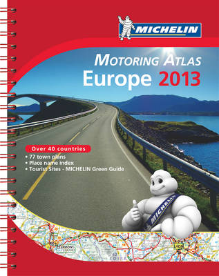
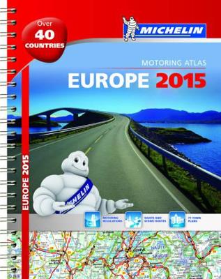
In addition to clear and accurate mapping, the Michelin motoring atlas Europe 2012 will help you optimise and add comfort to your journey: * Detailed mapping with a scale 1/500,000 - 1/3,000,000 * Mileage chart and journey times to help you plan your journey * Key to Map Pages to quickly access your region of interest * 77 town plans for easy navigation in urban areas * An extensive place name index to easily identify the destination of your choice * Comprehensive and detailed key to symbols used * Tourist information with place of interest and leisure facilities, as well as scenic routes, cross-referenced with the famous Michelin Green Guides, with towns underlined in green

2015 North America Road Atlas

by Michelin

Published 15 July 2014
NEW FEATURE! Michelin's updated, spiral-bound North America Road Atlas 2015 includes six new pages of annual US and Canadian events and festivals--inspiring travel or adding local color to a trip. The bonus section of GPS coordinates to 2000+ parks pinpoints sources of outdoor fun. Whether it's an epic adventure, a short road trip, or a quick jaunt, travelers appreciate the clear, accurate mapping. The atlas's big picture and road details help them on their journey, in advance or en route, while its tiled map pages complement online driving directions and GPS systems. Take to the road with confidence with Michelin's deluxe atlas.

France Atlas 2016

by Michelin

Published 12 November 2015


Michelin's Germany, Benelux, Austria, Switzerland, Czech Republic Tourist and Motoring atlas is the perfect companion for an enjoyable and safe drive in Germany and North East Europe. Convenient and easy to use thanks to its spiral bound cover, Michelin tourist and motoring altas will provide you with precise and reliable information with its annually updated mapping scaled 1/300,000 - 1/600,000 and motoring regulations. The route planner, the new street map pages as well as the time and distance charts will help you plan and optimise your journey. Tourist sights, leisure facilities and scenic route will add pleasure to your journey, whilst the new location map on top of each page will help you easily navigate within the atlas.

France Atlas 2017

by Michelin

Published 1 November 2016
France Road Atlas is the perfect companion for safe and enjoyable drive in France. Convenient and easy to use thanks to its spiral bound cover, Michelin France Atlas will provide you with precise and reliable information with its annually updated mapping scaled 1/200 000 (1 cm = 2 km). Smart and practical, this atlas includes tourist sights, leisure facilities and scenic routes recommended in the famous Michelin Green Guide as well 40 city plans with QTR codes for an easy access to your smartphone for online mapping and tourist information! Michelin's checklist will help you prepare your journey before your leave and Michelin's safety alerts will warn you about dangerous driving areas, such as steep hills and level crossing. Michelin's route planner as well as the time and distance charts will help you plan and optimise your journey. Michelin's France road atlas will make sure that you make the most of your journey in France!

Europe Atlas 2015

by Michelin

Published 7 April 2015
Michelin motoring atlas Europe is the perfect companion for an enjoyable and safe drive in Europe. Convenient and easy to use thanks to its spiral bound cover, Michelin motoring altas Europe 2014 covers 40 countries and will provide you with precise and reliable information with its annually updated mapping scaled 1/500,000 - 1/3,000,000 and local driving regulations. The route planner as well as the time and distance charts will help you plan and optimise your journey. Tourist sights, leisure facilities, and scenic route will add pleasure to your journey.

Spain & Portugal Atlas 2015

by Michelin

Published 7 April 2015
Michelin Spain & Portugal Michelin tourist and motoring Atlas is the perfect companion for an enjoyable and safe drive. Convenient and easy to use thanks to its spiral bound cover, Michelin Spain & Portugal Motoring Atlas will provide you with precise and reliable information with its annually updated mapping scaled 1/400 000 (1 cm = 4 km) and safety alerts. The route planner, as well as the time and distance charts will help you plan and optimise your journey, whilst the new location map on top of each page and the hightly practical street maps will provide you with an easy navigation within the atlas. Tourist sights, leisure facilities, and scenic route will add pleasure to your journey.