Walk! Instant-Books Digital Edition
9 total works
Apart from checking access to extant itineraries and revising certain routes and descriptions according to the suggestions of readers, eleven itineraries have been rewalked in order to incorporate new paths, variants proposed by readers, or to check that tricky trails had not been completely overgrown, and eight new walks have been incorporated.' Thank you to the thousands of walkers who have enjoyed the 2nd edition of Walk! Mallorca North & Montains, and especially to the many who have contributed ideas, advice and observations that Charles Davis has incorporated into his new 3rd edition; Mallorca's most popular walking guide book has just got even better.
7 kilometres, ascents & descents 200 metres, 4 refreshments (linear) Alternative Finish - Faro de Rasca to Los Cristianos 9 Mount Guaza - 4 walker, 21/2 hours, 9 kilometres, ascents & descents 430 metres, 0 refreshments (pan-handle circular) 10 Coastal Escapism - 3 walker, 3...hours, 14 kilometres, ascents & descents100 metres, 4 refreshments (linear) 11 Picos Las Americas - 3 walker, 1 hour, 3 kilometres (one way), ascents & descents 350 metres, 0 refreshments (linear) 12 Down to Town - 3 walker, 21/2 hours, 8.5 kilometres, ascents 130 metres, descents 650 metres, 0 refreshments (linear) 13 Adeje Skywalker & The White House - 4 walker, 3-3A hours, 12 kilometres, ascents 300 metres, descents 400 metres, vertigo risk, 0 refreshments (linear) Alternative (Drivers): Torviscas Alto The White House - 2/3 walker, 70 mins, 4.5 kilometres, ascents & descents 100 metres, 0 refreshments (linear) 14 Taucho Tour (La Quinta) - 3 walker, 11/2-2 hours, 6 kilometres, ascents & descents 300 metres, 0 refreshments (circular) 15 Wow!Spectacular to Adeje - 4 walker, 4 hours, 12 kilometres, ascents 150 metres, descents 1000 metres, vertigo risk, 0 refreshments (linear) 16 Queen of the South - 4 walker, 41/2 hours, 14 kilometres, ascents 250 metres, descents 900 metres, 2 refreshments (linear) 17 Walkers Who Lunch - new route 2012 - 2 walker, 31/2 hours, 15 kilometres, ascents 70 metres, descents 960 metres, 4 refreshments (linear) 18 Fantasia - 4 walker, 3 hours, 9 kilometres, ascents & descents 550 metres, 4 refreshments (circular, with linear option) 19 Table Mountain - 4 walker, 31/2 hours, 11 kilometres, ascents & descents 450 metres, 0 refreshments (linear) 20 GR131 Vilaflor - Ifonche - Arona - 4 walker, 51/2 hours, 18 kilometres, ascents 450 metres, descents 1200 metres, vertigo risk, 5 refreshments (linear) WALKS IN THE WEST 21 Wild West Tour - 3 walker, 2 hours, 7 kilometres, ascents 130 metres, descents 470 metres, 2 refreshments (linear) 22 An OK Corral - 3 walker, 1A hours, 5 kilometres, ascents & descents 170 metres, 0 refreshments (linear) 23 True Grit - updated version 2012 - 4 walker, 2A hours, 9 kilometres, ascents & descents 430 metres, 3 refreshments (circular) 24 Lasso La Hoya - new route 2012 - 3 walker, 1.
5 hours, 5 kilometres, ascents & descents 450 metres, 2 refreshments (circular) 25 Laurel & Hardy - 3 walker, 2 hours, 6.5 kilometres, ascents & descents 300 metres, 4 refreshments (circular) 26 Saddle Up and Round That Mountain - 4 walker, 3 hours, 9 kilometres, ascents & descents 450 metres, vertigo risk, 0 refreshments (circular) 27 Picnic at Hanging Rock & Guegue - 4 walker, 21/2 hours, 10 kilometres, ascents & descents 400 metres, vertigo risk, 0 refreshments (linear) 28 Survival of the Fittest - 6 walker, 6 hours, 17 kilometres, ascents& descents 600 metres, vertigo risk, 4 refreshments (linear) 29 The Scenic Route to Masca - 3 walker, 3 hours, 9 kilometres, ascents 300 metres, descents 850 metres, slight vertigo risk, 3 refreshments (linear) CENTRAL HIGH ALTITUDE WALKS 30 Toffee Mountain - 3/4 walker, 3 hours, 13.5 kilometres, ascents & descents 200 metres, 1 refreshments (circular) 31 Arenas Negras: Black Sand Surprise - 3 walker, 21/2 hours, 9 kilometres, ascents & descents 300 metres, 0 refreshments (circular) 32 La Fortaleza - 4 walker, 4 hours, 15 kilometres, ascents & descents 250 metres, 1 refreshments (linear) 33 Roques de Garcia - 3 walker, 1...hours, 4 kilometres, ascents & descents 140 metres, 1 refreshments (circular) 34 Paisaje Lunar: a Tenerife Classic - 3-5 walker, 2 hours, 7 kilometres, ascents & descents 320 metres, 0 refreshments (circular) 35 Lunar Orbit 2 - 3 walker, 21/2 hours, 9.
5 kilometres, ascents & descents 370 metres, 0 refreshments (circular) 36 Mighty Guajara - 5 walker, 41/2 hours, 10 kilometres, ascents & descents 720 metres, 1 refreshments (linear/circular) 37 Siete Canadas - 3/4 walker, 4 hours, 16.4 kilometres, ascents & descents 200 metres, 1 refreshments (linear) 38 The Big One - Crater Rim Challenge - 5 walker, 61/2 hours, 18 kilometres, ascents 300 metres, descents 900 metres, vertigo risk, 2 refreshments (linear) 39 Parador - Degollada de Guajara - Paisaje Lunar - Vilaflor - 5 walker, 6 hours, 18 kilometres, ascents 300 metres, descents 1000 metres, 2 refreshments (linear) 40 On Top of the World - Mount Teide - 4/5 walker, 4 hours, 10 kilometres, ascents 180 metres, descents 1200 metres, 0 refreshments (linear) ANAGA MOUNTAIN WALKS 41 Las Mercedes - Llano de los Loros - 3 walker, 11/2 hours, 5 kilometres, ascents & descents 150 metres, 2 refreshments (pan-handle circular) 42 Cruz del Carmen Circular - 4 walker, 4 hours, 10.8 kilometres, ascents & descents 460 metres, 2 refreshments (pan-handle circular) 43 Casa Carlos - Taborno - 4 walker, 21/2 hours, 6 kilometres, ascents & descents 390 metres, 1 refreshments (linear) 44 Las Carboneras - Taborno - 3 walker, 1.
..hours, 3 kilometres, ascents & descents 170 metres, 0 refreshments (linear) 45 Ensillada Recreation Area - Chamorga - 4 walker, 3 hours, 7 kilometres, ascents 100 metres, descents 450 metres, 1 refreshments (linear) 46 Chamorga Circular - 4/5 walker, 4+ hours, 9 kilometres, ascents & descents 780 metres, 1 refreshments (circular) Glossary. Appendix B: Other Walking: Montana Blanca & Barranco del Infierno Place Names Index
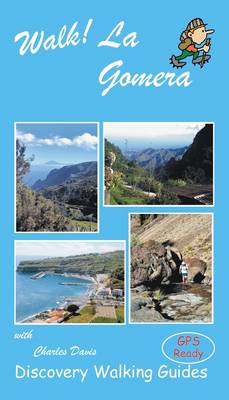
3 Los Roques, 3 hrs, 10.5 kms, asc & desc 700 mts (circular). 4 Pista Forestal de Majona & Playa de la Caleta, 5.5 hrs, 23 kms, asc 500 mts, desc 950 mts, vertigo risk (lin). 5 Barranco & Lomo de Azadoe, 1.5 hrs, 4 kms, asc & desc 250 mts (circ). 6 Jerdune - Jardin Tecina, 3.5 hrs, 14 kms, asc 250 mts, desc 1150 mts (lin). 7 Las Toscas - Degollada de Peraza, 2.8 hrs, 10 kms, asc 600 mts, desc 300 mts (lin). 8 Playa Santiago - Targa, 4.3 hrs, 17 kms, asc & desc 750 mts (circ). 9 Barranco de Benchijigua, 4 hrs, 12 kms, asc & desc 600 mts (circ). 10 Barranco de Guarimiar, 4.1 hrs, 13 kms, asc & desc 850 mts, vertigo risk (circ). 11 Imada - Garajonay, 3 hrs, 12.5 kms, asc & desc 500 mts (circ). 12 Arure - Las Hayas, 3.3 hrs, 13 kms, asc & desc 300 mts (circ). 13 Las Creces Roundabout Route, 2.4 hrs, 10 kms, asc & desc 300 mts (circ). 14 Cercado - Valle Gran Rey, 2.2 hrs, 10 kms, asc & desc 300 mts (circ). 15 La Merica, 2.2 hrs, 10 kms, asc 100 mts, desc 800 mts (lin). 16 Valle Gran Rey - Hayas, 3 hrs, 8 kms, asc & desc 650 mts, vertigo risk (circ). 17 Chipude - Garajonay, 3.4 hrs, 14.5 kms, asc & desc 500 mts (circ). 18 Fortaleza, 1.7 hrs, 4.7 kms, asc & desc 250 mts (circ).
19 Barranco de Erque, 5.5 hrs, 13 kms, asc & desc 750 mts, vertigo risk (circ). 20 Ermita de Nuestra Senora de Guadalupe, 3 hrs, 10 kms, asc & desc 350 mts (circ). 21 Tequergenche, 3.3 hrs, 12 kms, asc & desc 350 mts (lin). 22 Barranco de Argaga, 5 hrs, 11 kms, asc & desc 850 mts (circ). 23 Barranco de Arure, 1.5 hrs, 4.5 kms, asc & desc 200 mts (lin). 24 Lomo del Carreton, 3 hrs, 4.5 kms, asc & desc 600 mts, vertigo risk (circ). 25 Barranco de Guaranet, 3+ hrs, 10 kms, asc & desc 500 mts (circ). 26 Las Mimbreras, 1.4 hrs, 4.5 kms, asc & desc 200 mts (circ). 27 Hayas - Vallehermoso, 2.8 hrs, 9.5 kms, asc 250 mts, desc 900 mts (lin). 28 Roque Cano, 3 hrs, 10.5 kms, asc & desc 600 mts (circ). 29 Ermita de Santa Clara + Chorros de Epina, 4 hrs, 14 kms, asc & desc 650 mts (circ). 30 Las Rosas - Hermigua, 2.3hrs, 8.5 kms, asc 200 mts, desc 600 mts (lin). 31 Pared de Agulo, 3 hrs, 10 kms, asc & desc 600 mts, vertigo risk (circ). 32. The Head of the Table & The Fat Back, 5 hrs, 14 kms, asc & desc 750 mts, vertigo risk (circ). 33 El Cedro Tunnel, 1 hr, 4.5 kms, asc & desc 250 mtrs (circ). 34 Classic Garajonay, 3.5 hrs, 10 kms, asc 150 mtrs, desc 1000 mtrs, vertigo risk (lin).
Walk La Gomera's walking routes are also available as Viewranger routes to use on your 3G phone or tablet. GPS waypoint files (in gpx format) are available for free download at Discovery Walking Guides website.
It features: route summary of exertion rating; refreshments rating; time, distance, ascents/descents; and more.
If this sounds divine or like some lost paradise, you're not the first to think so, previous commentators have identified La Palma as the prototype for both the Elysian Fields and Atlantis! The fanciful stuff aside, the island is a walker's idyll, utterly tranquil, verdant and almost unspoiled. GPS Waypoint files (in gpx file format) for Walk! La Palma are available as a free zip file download on Discovery Walking Guides website. Synopsis 34 detailed walking route itineraries. Each of it includes:- walking route summary; ratings for Effort, Time, Distance, Ascents/Descents, Refreshments and Vertigo risk; and more. It also provides background information along with details of accommodation, buses, official walking routes, mountain biking, museums, and information offices. Walk! La Palma walking routes are also available as Viewranger routes for use on your 3G phone or tablet.