Oxford Archaeology Monograph
7 primary works
Book 21
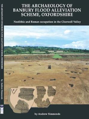
The Archaeology of Banbury Flood Alleviation Scheme, Oxfordshire
by Andrew Simmonds
Published 23 April 2014
This volume presents the results of investigations undertaken by Oxford Archaeology between 2003 and 2011 in advance of construction of the Banbury Flood Alleviation Scheme, Oxfordshire. The main element of these investigations was an excavation at the site of a borrow pit for clay to be used in constructing the flood defences. Geophysical surveys of two other areas that revealed dense concentrations of buried archaeological remains not subsequently affected by the scheme are also reported.
The excavation uncovered a multi-period landscape containing a regionally significant Neolithic occupation site, as well as later features. The Neolithic remains comprised 35 pits that produced large assemblages of flint and pottery, mainly Peterborough Ware of middle Neolithic date (associated with radiocarbon dates of c 3350-2650 BC). A single substantial but enigmatic middle Bronze Age ditch contained few finds, but these included a radius from an aurochs, one of the latest examples of this species in Britain.
Late pre-Roman Iron Age occupation was represented by an oval double-ditched enclosure which, following a brief hiatus, was succeeded toward the end of the 1st century AD by a more extensive low-status farmstead. The settlement was redeveloped during the 2nd century before finally being abandoned in the early-mid 3rd century. Artefactual and palaeoenvironmental assemblages, as well as the spatial arrangement of the settlement, provided evidence regarding the economy, status and social organisation of the community. The volume includes a consideration of the results of the project in the context of Iron Age and Roman settlement of the Cherwell Valley.
Book 25
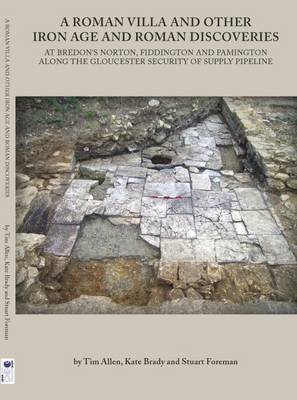
A Roman Villa and Other Iron Age and Roman Discoveries
by Tim Allen, Kate Brady, and Stuart Foreman
Published 27 April 2016
This report presents the results of archaeological investigations along the 17km-long Gloucester Security of Supply Water Pipeline in the vicinity of Tewkesbury. The archaeological mitigation works were commissioned by Severn Trent Water; following evaluation of the whole route, three sites were chosen for excavation, at Fiddington and Pamington in Gloucestershire and at Bredon’s Norton in Worcestershire.
The site at Pamington revealed oval enclosures of mid-late Iron Age date, that at Fiddington elements of a rural settlement spanning all of the Roman period. At Bredon’s Norton the pipeline cut through a series of Iron Age and Roman settlement enclosures and their internal features, and also included human burials of both periods. Unusually, one Iron Age burial was accompanied by a saw, and among the Roman burials was a cemetery of seven newborn infants.
An unexpected discovery was the remains of a Roman bath-house with a plunge pool flagged with stones and decorated with painted wall-plaster. This was later drained and had a central cistern inserted, while the loft was used to store grain. The building was destroyed by fire at the very end of the Roman period, resulting in the exceptional preservation of charred grain, together with fragmentary timbers, on the floor.
Book 27
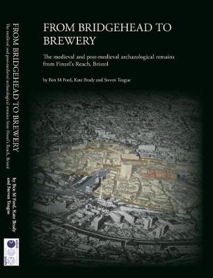
This richly illustrated book presents the fascinating results from a major project to examine the heritage of Finzel’s Reach, the site of the former Courage and Bristol Breweries near the centre of one of England’s greatest port cities. Archaeological, geoarchaeological and historic building investigations have revealed a fascinating story of change and urban evolution at the site. Naturally a tidal marsh, the area played an important role in the late Saxon defensive system protecting the settlement of Brycg Stowe. From the twelfth century large-scale land reclamation provided the conditions for speculative urban street and tenement development, promoted and administered under the ownership of the Knights Templar, and from the fourteenth century by new owners, the Knights Hospitaller. These medieval urban landlords oversaw the growth of an established and densely populated area full of life, trade and production on one of the town’s principal roads, Temple Street, and crossroads, Temple Cross. Later medieval and early post-medieval decline gave way to new enterprises in the age of Empire, leading to the site’s long-standing association with sugar production and brewing.
The accompanying DVD contains documentation that formed the basis of the heritage strategy and guided its implementation, along with a complete set of full specialist reports on the artefacts and ecofacts recovered, and reports on the historic building recording of the brewery structures as they survived before modern redevelopment. A photo gallery and short film illustrate the work of the archaeologists who undertook the excavations.
The accompanying DVD contains documentation that formed the basis of the heritage strategy and guided its implementation, along with a complete set of full specialist reports on the artefacts and ecofacts recovered, and reports on the historic building recording of the brewery structures as they survived before modern redevelopment. A photo gallery and short film illustrate the work of the archaeologists who undertook the excavations.
Book 30
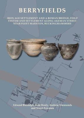
Berryfields
by Edward Biddulph, Kate Brady, Andrew Simmonds, and Stuart Foreman
Published 11 November 2019
Excavations carried out by Oxford Archaeology at Berryfields to the north-west of Aylesbury in Buckinghamshire uncovered the remains of a middle Iron Age settlement and the agricultural hinterland of the nucleated Roman settlement of Fleet Marston, situated on the major Roman road of Akeman Street.
This volume describes the results of the fieldwork and analysis of an exceptional range of the artefactual and environmental evidence, including timber piles, which supported a bridge that carried the Roman road over the River Thame, and a wooden basket, chickens’ eggs and many other objects ritually deposited into a waterlogged pit in the late Roman period. In addition, the volume presents evidence for a long-lived late prehistoric territorial boundary, malting and brewing and other roadside trades and crafts, as well as funerary activity, comprising roadside burials and a possible pyre site. It also reveals the importance of livestock, especially horses, in the middle Iron Age and Roman economies.
Crucially, the volume draws on the findings to shed light on the character of Roman Fleet Marston, which hitherto has been known only from chance finds. Evidence from Berryfields and other sites in the area shows that over time, Fleet Marston found itself at the intersection of several routeways that took travellers into the countryside and on to major towns. Its position at this important crossroads, together with hundreds of coins and other finds, potentially identifies the settlement as a market-place or administrative centre with extensive trade connections, a role that would be continued in Aylesbury in the medieval period and to the present day.
Book 31
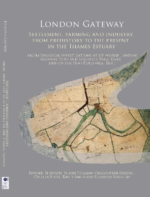
London Gateway
by Edward Biddulph, Stuart Foreman, Christopher Hayden, Cynthia Poole, and Kirsty Smith
Published 28 May 2022
Archaeological investigations were carried out by Oxford Archaeology between 2008 and 2016 within DP World London Gateway Port and Logistics Park near Stanford-le-Hope in Essex and on the site of a compensatory wildlife habitat on the Hoo Peninsula in Kent. Some 40 sites were the subject of some form of archaeological assessment, and of these, 16 contained significant archaeological remains or were otherwise important to the understanding of the area. The combined evidence paints a picture of life on the edge of the Thames Estuary from early prehistory to the 20th century.
The discoveries show how the area has attracted settlers, farmers and traders since prehistory. People came to the marshes in Mesolithic and Neolithic times, perhaps on a seasonal basis, to hunt, and gather plants and seafood. In the late Bronze Age, Iron Age and Roman periods, people trapped seawater to extract salt, a valuable commodity used for food preservation. In the medieval period, the marshland offered unrivalled pasture for the sheep and cattle belonging to upland farms on the gravel terraces. Over time, the marshes were drained to increase the pasture and the value of the farming estates. The creeks that snaked through the marshes were a means of communication and trade. A timber wharf, built in the 16th century, was recorded on the edge of one such creek. In modern times, the sparsely populated area proved an ideal location for the establishment of oil refineries and other industries, positioning London Gateway at the heart of British trade. The area has also inspired artists, writers and filmmakers.
This volume joins two others - London Gateway: Maritime Archaeology in the Thames Estuary and London Gateway: Iron Age and Roman Salt Making in the Thames Estuary - that explore the archaeology and heritage of the London Gateway site.
Book 33
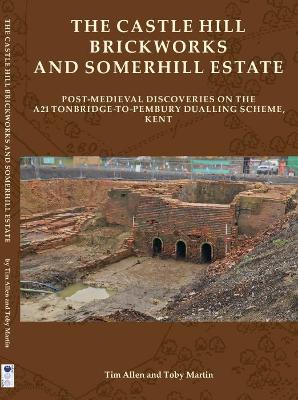
The Castle Hill Brickworks and Somerhill Estate
by Tim Allen and Toby Martin
Published 15 December 2021
Excavation by Oxford Archaeology for the A21 Tonbridge to Pembury Dualling Scheme in Kent uncovered the well-preserved remains of a 19th-century rural estate brickworks, very few examples of which still survive. The Castle Hill Brickworks was established by 1833 within the grounds of the Somerhill Estate, and continued to produce bricks, tiles and drains for the estate and the local area until the 1930s. The excavated remains included three kilns, six drying sheds, a workshop and two pugmills, together with a cottage, office, clay pits and ponds, and provide the most complete picture of a rural brickworks that has been published from anywhere in the south-east of England.
Construction of the road necessitated the removal of Burgess Hill Farm, one of the post-medieval farms attached to the estate. Following the dismantling of the listed barn and stables for re-erection at the Weald and Downland Living Museum and the recording and demolition of the farmhouse and other buildings, trenches were excavated to characterise the below-ground remains and corroborate the building
sequence.
Both the brickworks and the farm were situated alongside the Tonbridge to Hastings road (later the A21), and between them a turnpike milepost was found in situ, and the remains of the 17th/18th-century road were preserved at a passing place on the slope up to Castle Hill, where timber for the brickworks was grown.
Book 37
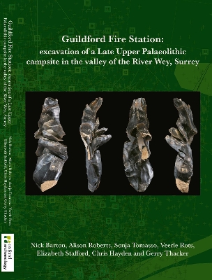
Guildford F ire Station
by Nick Barton, Alison Roberts, Sonja Tomasso, Veerle Rots, Elizabeth Stafford, Christopher Hayden, and Gerry Thacker
Published 14 June 2024
Excavations carried out prior to the construction of a new fire station in
Guildford, Surrey, revealed a well preserved, in situ Late Upper Palaeolithic flint
scatter. The site lay on cold climate fluvial sandy gravels deposited in braided
stream systems prior to the onset of the Late Glacial (Windermere) interstadial.
Typological analysis of the flint and OSL dates suggest that the scatter itself dates
from the first half of the Late Glacial (Windermere) interstadial (c 1415KBP).
The lithic assemblage is homogeneous and, apart from initial extraction and
nodule testing, all stages of flint manufacture are represented. Two main
concentrations of knapping are represented, the main focus of which were the
production of blade blanks some of which were removed from the site. Functional
analysis of the tools suggests relatively short occupation during which hunting,
smallscale craft activities linked with the retooling of hunting weapons and the
manufacture of hide items, and limited processing of animal and plant materials
took place.
The assemblage is comparable to that from Wey Manor Farm, Surrey, 17km
further downstream, and raises the question of the relationship between the
two sites. Both share technological and typological features in common with
the Creswellian, though Wey Manor Farm has a greater diversity in lithic point
types. Comparison with Continental assemblages suggests that the Surrey sites
share affinities with the Older Azilian or equivalents in northwest France and
Germany and implies strong postMagdalenian influences in the Late Upper
Palaeolithic of Britain.