West Midlands Railways Through Time

by Ray Shill

Published 15 December 2014
While the first public passenger-carrying railway operated between Liverpool and Manchester from 1830, it was the construction of the Grand Junction and London & Birmingham that created the first long-distance, inter-city route from 1838. The meeting point of these two independent companies was Birmingham. The new railways came to benefit the town, through the carriage of goods, parcels and passengers and complimenting the already extensive canal network in the area.

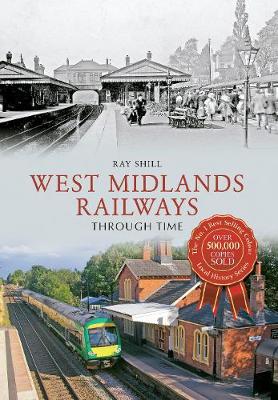
In addition to the London & Birmingham and Grand Junction, railways to Gloucester and Derby were constructed. That to Derby joined up with railways to Nottingham, Sheffield and Leeds, placing Birmingham at the heart of an inter-city rail network. The aim of this book is to investigate railway construction within the West Midlands, showing how the system developed and how it served both the needs of the travelling public and the conveyance of goods and merchandise.
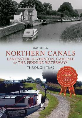
The Wyrley & Essington Canal began as an independent waterway, carrying coal from Essington and Wyrley Bank to Wolverhampton. It was a popular route, in high competition with the mines at Bilston, Cosely and Tipton, which were served by Birmingham Canal Navigations. In 1792 and 1794 the canal was extended, creating routes to a number of new areas - five locks were used for a branch canal to Essington 'New' Colliery, the highest point on the Wyrley & Essington Canal. Although useful in supplying water to adjacent navigations, trade on the Wyrley & Essington Canal failed to achieve its full potential, which led to closures along the canal throughout the period. Despite this, trade improved in 1840 when the waterway merged with Birmingham Canal Navigations. In this illustrated book, author Ray Shill details the development of the Wyrley & Essington Canal and delves into its fascinating history.

Northern Canals Through Time follows on from the previous title by well-known author Ray Shill, North West Canals Through Time: Manchester, Irwell & the Peaks, as a study of waterway infrastructure, in this case focusing particularly on Lancaster, Ulverston, Carlisle, and the Pennine Waterways from west to east, including from Nelson to Leeds on the Leeds & Liverpool, the canal from Rochdale to Sowerby Bridge on the Rochdale and the Huddersfield (Narrow) from Ashton to Huddersfield.

Through a similar 'then and now' study, in line with his previous titles, canal historian Ray Shill explores the construction and technical developments of the canals and their social and economic contributions to the towns and cities they passed through, as well as the architecture they spawned and the legacy they left behind them. Within the pages of this book, the history of the canals will be unfolded to delight and inform all those interested in the canals of the North.

North East Canals Through Time

by Ray Shill

Published 15 September 2014
North East Canals Through Time follows on from previous titles by specialist author and canal historian Ray Shill, notably North West Canals Through Time: Manchester, Irwell & the Peaks. As a study of the waterway infrastructure of North East England, this volume focuses particularly on Aire & Calder, Calder & Hebble, Huddersfield Broad Canals, Dearne & Dove, and Barnsley. A broad and varied array of historic and modern photographs complements this insightful commentary.

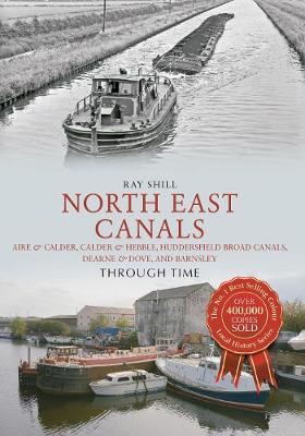
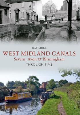
Throughout this volume, Ray Shill explores the construction and technical developments of the canals and their contributions to the habitations they passed through, as well as the architecture they spawned and the legacy they left behind. This book will fascinate anyone with an interest in this region and its long-established waterway infrastructure.
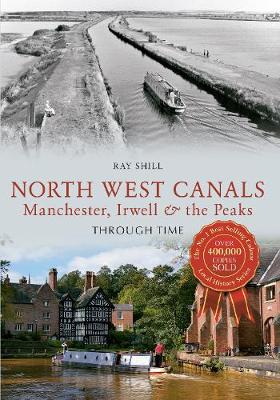
In this, the second of two books examining the history and development of canals in the Midlands, Ray Shill traces the waterways of the East Midlands, from the early river navigations, such as the Trent with its iconic Trent Boats and through the heady years of 'Canal Mania', when grand structures such as the Dove Aqueduct and Rainbow Bridge flourished and engineers pushed the boundaries of technology, driven by the advent of mining and industry across the region. The influence of the inland ports and the arrival of the railways is considered, as are the later developments that drew inspiration from canals on the continent. Finally, Ray takes stock of the current state of the canal system and celebrates some of the laudable conservation schemes across the East Midlands. This volume makes use of a stunning collection of rare colour photographs to tell the story of the region's unique canal system and its valuable legacy.

There is a great diversity in the waterways of the North West. Within Merseyside and Deeside there were early river navigations and barge canals. Both were used by a common vessel - the flat - which operated to provide a single means of transport for this area. Navigations stretched out in different directions to tap the coalfields around Wigan, reach the salt works of Northwich and Winsford, and bring cotton to the mills of Manchester. The waterways serving these areas included: River Douglas Navigation, Leeds & Liverpool Canal, Mersey & Irwell Navigation, Weaver Navigation, Chester Canal, Ellesmere Canal and Sankey Brook Navigation, all of which connected to the canal network at Preston Brook and Nantwich. Ray Shill details the development of these individual waterways and delves into the history behind them to inform and delight all.

The history of the canals and waterways of North West England, including the Ashton Canal, Peak Forest Canal, Rochdale Canal, Huddersfield Canals, Manchester Bolton & Bury Canal and River Ribble, is traced through old and modern colour photographs. This is the second volume of North West Canals Through Time. The first volume, North West Canals Through Time: Merseyside, Weaver & Chester, was published in July 2013. Canal historian Ray Shill explores the construction and technical developments of the canals and their social and economic contributions to the towns and cities they passed through, as well as the architecture they spawned and the legacy they left behind them. Within the pages of this book, the history of the canals will be unfolded to delight and inform all those interested in the canals of the North West.

This book is a study of waterways infrastructure and investigates through images and maps how the present midland network of canal and river navigations was put together. It is a complex history where some working waterways are approaching 250 years of existence, but where others span the distance of time with construction and modification extending right up to the present day. In some instances their existence has been sound and with other cases fragile. Many might have disappeared by now, were it not for a unique set of circumstances and a British passion for the past. English and Welsh Canals and River Navigations, in 2012, face one of the most of the most important challenges since 1948 when waterways owned and maintained by British Waterways pass into the control of the Canal and River Trust. The present situation is further complicated by the fact that not all navigations in England and Wales were nationalised. A portion of the railway owned canals had also been abandoned and some independent canals had closed before that time and were not considered in the nationalisation package. Others, such as the Derby Canal, lingered on in private ownership until complete abandonment occurred.