
The city: a place of hopes and dreams, destruction and conflict, vision and order. The first city atlas, the Civitates Orbis Terrarum, was published by Braun and Hogenburg in 1572 for the armchair traveller interested in a world that was opening up around him. Since then our fascination with foreign cities has not abated. This sumptuous volume looks at the development of the mapping and representation of the city revealing how we organize the urban space. From skyline profiles, bird's eye views...
Maps are the manifestation of an intellectual construct of physical and metaphysical environments. They are rich cultural objects presenting and transmitting information about time and place of production. A map is not neutral - it is an interactive, constructed representation of space as perceived and presented by its maker and then interpreted by the viewer. Maps thus reveal methodological relationships between artistic and scientific approaches, aesthetics and functionality and form and conte...

Maps can tell much about a place that traditional histories fail to communicate. This lavishly illustrated book features 70 maps which have been selected for the particular stories they reveal about different political, commercial and social aspects of Scotland's largest city. The maps featured provide fascinating insights into topics such as: the development of the Clyde and its shipbuilding industry, the villages which were gradually subsumed into the city, how the city was policed, what lies...
Ordnance Survey of Northern Ireland (House of Commons Papers, No. 47 (Session 1997-98))
by M.J.D. Brand
“Carlsen sees a world of wonder hiding in plain sight and may just change how you look at the world around you.” - TODAY Show A simple walk around the block set journalist Spike Carlsen, bestselling author of A Splintered History of Wood, off to investigate everything he could about everything we take for granted in our normal life—from manhole covers and recycling bins to bike lanes and stoplights. In this celebration of the seemingly mundane, Carlsen opens our eyes to the engineering marvels...
Russia first encountered Alaska in 1741 as part of the most ambitious and expensive expedition of the entire eighteenth century. For centuries since, cartographers have struggled to define and develop the enormous region comprising northeastern Asia, the North Pacific, and Alaska. The forces of nature and the follies of human error conspired to make the area incredibly difficult to map. Exploring and Mapping Alaska focuses on this foundational period in Arctic cartography. Russia spurred a golde...
One of the most visited places in the world, Rome attracts millions of tourists each year to walk its storied streets and see famous sites like the Colosseum, St. Peter's Basilica, and the Trevi Fountain. Yet this ancient city's allure is due as much to its rich, unbroken history as to its extraordinary array of landmarks. Countless incarnations and eras merge in the Roman cityscape. With a history spanning nearly three millennia, no other place can quite match the resilience and reinventions of...
Cartographic Relief Presentation (ESRI Press Classics)
by Eduard Imhof
Eduard Imhof's classic book Cartographic Relief Presentation is once again available. Within the discipline of cartography, few works are considered classics in the sense of retaining their interest, relevance, and inspiration with the passage of time. One such work is Imhof's masterpiece on relief representation. As a unique display of analysis and portrayal, this is an outstanding example of the need for cartography to combine intellect and graphics in solving map design problems. The range, d...
The History of Cartography, Volume 3, Part 2 (History of Cartography, #3)
When the University of Chicago Press launched the landmark History of Cartography series nearly thirty years ago, founding editors J.B. Harley and David Woodward hoped to create a new basis for map history. They did not, however, anticipate the larger renaissance in map studies that the series would inspire. But as the renown of the series and the comprehensiveness and acuity of the present volume demonstrate, the history of cartography has proven to be unexpectedly fertile ground. "Cartography...

Mobile Mapping Symposium
Details the teaching of computer mapping, the use of mapping as a teaching and research tool, and effective techniques in epidemiology research. Companion to Volumes 11 and 16.
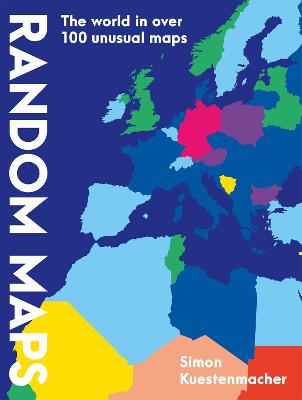
What would the world be without maps? How would we orientate ourselves? How would we travel? How could we plan streets or entire cities? We encounter maps everywhere in everyday life. But they can do much more than just represent the topography of places. The geographer Simon Kustenmacher collects exciting, entertaining and useful maps that open up a new perspective on the world in an extraordinary way. Where on Earth do most people live? What does the world look like from a dolphin's point of...
Mapping the Nation
Mapping the Nation: Governments Coordinated Responses to Crises continues the pattern of annual national mapping books from Esri that highlight inspiring GIS work by the public sector. This year, this book focuses on the many ways GIS can help governments in times of crisis. These stories highlight how GIS was applied during the COVID-19 pandemic with a focus on how the public sector uses GIS to serve all people. Mapping the Nation: Governments Coordinated Responses to Crises details how GIS hel...
Beautiful, accurate, and up-to-the-minute, this completely updated mini atlas puts the entire world in the palm of your hand in an amazingly accessible format. National Geographic's maps and atlases are critically acclaimed and world-renowned for their accuracy, originality, authoritative content, and clean design. Now, the most convenient package of this trusted map content has been completely updated in Compact Atlas of the World, Second Edition. Sized at 4 x 6 inches with a resilient soft co...
County Atlases of the British Isles Published After 1703
by Donald Hodson
Between 1680 and 1807 British publishers produced a sequence of double-hemisphere world maps each printed on two sheets and conjoined. These maps are a peculiarly British phenomenon of this period and they provide a key indicator of the way the British map trade specifically targeted a newly prosperous and upwardly aspiring class of purchasers. The buyers were hungry for geographical information, but were also eager to acquire such maps for display, as a statement of their intellectual pursuits....