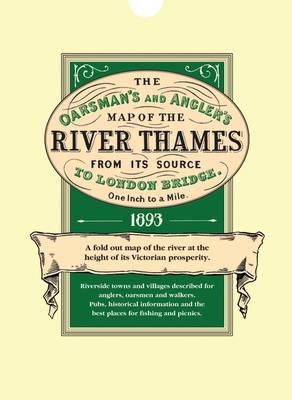
Explore Britain's best loved waterway with the map that must surely have been used by the Three Men in a Boat. Very detailed, one inch to the mile and over 8 feet in length, it shows all 164 miles from the source to London. Riverside towns and villages are marked with historical information and details of the locks and how to operate them. For fishermen, the best pools where trout, pike, perch and others were to be found. There are also details of toll charges and angling laws and a description of life on the river over a century ago when the Thames was the nation's favourite place for recreation and sport. The map is concertina folded in a protective wallet.
- ISBN10 1873590016
- ISBN13 9781873590010
- Publish Date 1 January 1991
- Publish Status Out of Print
- Out of Print 29 August 2015
- Publish Country GB
- Publisher Bloomsbury Publishing PLC
- Imprint Shire Publications
- Edition Facsimile of 1893 ed
- Language English