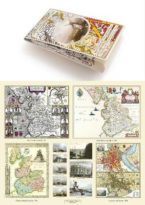
A Lancashire 1611 - 1836 - Fold Up Map that features a collection of Four Historic Maps, John Speed's County Map 1611, Johan Blaeu's County Map of 1648, Thomas Moules County Map of 1836 and a Plan of Lancaster and Preston from 1824. The maps also feature early Victorian views around Liverpool as well as Manchester and Blackpool. (Historic English Counties Collection, #19)

Mapseeker Archive Publishing Ltd Mapseeker Archive Publishing Ltd (Creator)

0 ratings • 0 reviews • 0 shelved
Book cover for A Lancashire 1611 - 1836 - Fold Up Map that features a collection of Four Historic Maps, John Speed's County Map 1611, Johan Blaeu's County Map of 1648, Thomas Moules County Map of 1836 and a Plan of Lancaster and Preston from 1824. The maps also feature early Victorian views around Liverpool as well as Manchester and Blackpool.

Bookhype may earn a small commission from qualifying purchases. Full disclosure.

  • ISBN13 9781844918478
  • Publish Date 12 December 2018
  • Publish Status Active
  • Publish Country GB
  • Publisher Historical Images Ltd
  • Imprint Mapseeker Archive Publishing
  • Format Paperback
  • Pages 1
  • Language English